Facoltà di Ingegneria
Dottorato in Ingegneria Ambientale
XXXI Ciclo
STRUCTURAL JOINT INVERSION OF ELECTRICAL AND
SEISMIC TOMOGRAPHY DATA
Candidate:
Thesis advisor:
Ing. Lucia Palladini
Prof. Michele Cercato
Coordinator:
Prof.ssa M. R. Boni
2
Contents
Introduction ... 4
1. Definition of hydrogeophysics ... 6
2. Hydrogeologic and electric properties of rocks and soils ... 10
2.1. Hydrogeologic properties... 10
2.2. Electric properties: resistivity, conductivity and dielectric constant ... 12
2.3. Seismic velocities... 13
3. Relations between hydrogeologic and electrical properties of rocks and soils ... 16
3.1. Permittivity models ... 16
3.2. Electrical conductivity models ... 17
3.3. Relations between seismic and hydrogeological properties ... 19
4. Inversion methodology ... 21
4.1. Forward Modelling... 21
4.1.1. Electrical methods... 22
Introduction to the finite elements method ... 22
Application of the finite element method to the resistivity problem ... 24
4.1.2. Seismic methods: The Fast Marching Method ... 27
4.1.3. The Multistencils Fast Marching Method ... 34
4.1.4. Implementation of the Multistencils Fast Marching Method ... 36
4.2. Inversion Theory ... 41
4.3. Joint inversion... 45
4.3.1. Cross-gradientsfunction ... 47
4.4. Inversion Metodology... 49
4.5. Algorithm for the joint inversion ... 52
5. pyGIMLi ... 55
6. Results ... 56
6.1.1. Joint inversion results... 56
3
6.1.3. Synthetic model with noise ... 61
6.1.4. Field data: Rieti ... 66
6.2. Seismic forward modeling results ... 73
6.2.1. Comparison between computed and analyc traveltimes for a two-layer model ... 73
6.2.2. Separated SRT inversion for the synthetic model without noise ... 78
6.2.3. Joint inversion for the synthetic model without noise ... 81
6.2.4. Separated and joint inversion for the synthetic model with noise ... 84
6.2.5. Separated and joint inversion for field data ... 88
Conclusions ... 93
4
Introduction
This research project has been focused on the achievement of the structuraljoint inversion of two geophysical methods. The final target is to obtain a high resolution characterization of the shallow subsurface.
The aim of determining petrophysical properties, structural boundaries, etc, can be obtained through the integration of different information that derives from various geophysical methods. In fact, since each method is sensitive to a specific physical property, their integration can lead to an accurate final model. However, if such integration is conducted individually inverting the data sets, the final model will be affected by the resolution limitations of each method. For this reason, an important tool has been developedin geophysical applications: thejoint inversion. Two different approaches can be used to carry out the joint inversion: the petrophysical one, in which a petrophysical relationship is used, and the structural one, in which a structural similarity between models is imposed (Gallardo and Meju, 2004). Specifically, I decided to implement the algorithm for the structural joint inversion and specifically the structural approach developed by Gallardo and Meju (2003, 2004), since from literature it results to be the most robust method in the joint inversion (Moorkamp, 2017). In this process, an objective function that includes the objective function of each geophysical method is build and simultaneously minimized. In conclusion, the joint inversion may improve the resolution of each geophysical model and bring to models that are more accurate and easier to interpret.
Specifically, in this thesis, the electrical resistivity tomography (ERT) and the seismic refraction tomography (SRT) have been used to carry out the joint inversion. Both these high-resolution methods can be crucial in environmental and engineering applications, as for the geotechnical characterization of a site or for the detection of hydrological resources. Since the resistivity range overlaps for the different materials, resistivity measurements cannot be related to a specific soil or rock. Because of that, it would be better to obtain other information, for example from the seismic tomography. In fact, this method allows not only the reconstruction of the seismic wave velocities with depth, but also to obtain a good lateral resolution. Instead, the Ground Penetrating Radar (GPR) has not been considered since it presents some limits in the investigation depth, due to the high attenuation of electromagnetic energy in porous conductive media.
In addition to the integrated inversion, another goal has been obtained in this thesis: the implementation of the forward modeling for the seismic method and specifically, the Multistencils Fast Marching Method (MSFMM). This method can be seen as an extension of the FMM, that is considered from literature the fastest and the most efficient method for the solution of the eikonal
5
equation and accordingly for the computation of the first arrivals traveltimes. In particular, the MSFMM improves the accuracy and the efficiency of the FMM, since it considers also the information that derives from the diagonal directions.
Both the algorithms, the one of the joint inversion and the one of the forward modeling for the seismic method, have been implemented in Python language and integrated in the open-source software pyGIMLi.
In the first chapter, the definition of hydrogeophysics has been given with a little description of the different geophysical methods and their applications in the hydrogeophysics field.
In chapters 2 and 3, a little summary of the hydrogeologic and electric properties and of their mutual relationships has been made, in order to highlight the most used petrophysical relationships for the different geophysical methods, even if the joint inversion has been conducted following the structural approach and not the petrophysical one.
In chapter 4 different elements are described: the forward modelings for both electrical and seismic method; the general inversion theory and the joint inversion, with the description of the implemented algorithm for the joint inversion. Specifically, concerning the forward modelings, the finite elements method is explained for the electrical method. Instead, for the seismic method, a brief description of the FMM for both, structured and unstructured mesh, is given. In addition, the Multistencils Fast Marching Method is presented with the implementation of the method itself. Then, the general inversion theory is explained with the joint inversion and the cross-gradients function. In the end, the inversion methodology and the implementation of the algorithm used for the joint inversion are presented.
Chapter 5 presents a brief description of the open source program that has been used and specifically the pyGIMLi package.
At the end, in chapter 6 the results obtained by the implementation of the algorithm for the joint inversion and for the seismic forward modeling are shown, while, in chapter 7 the final comments and conclusion are discussed.
6
1.
Definition of hydrogeophysics
Hydrogeophysics has been developed over the years to improve our understanding of the hydrological processes of the shallow subsurface through the application of geophysical techniques. More specifically, hydrogeophysics is capable of investigating the subsurface processes to estimate the flux parameters and transport models. This is especially important for the shallow subsurface, which contains not only the majority of water resources employed for agricultural support, but is also the recipient of most pollutants and contaminants (Rubin and Hubbard, 2005).
The importance of geophysical methods lies in the fact that traditional sampling techniques used for the characterization or monitoring of the shallow subsurfaceare point-like by definition and may not be capable to image the key hydrogeologic features of the subsoil because of lateral variations, scale effects and heterogeneity.On the other hand, geophysical methods are capable of imaging lateral and vertical variations in the physical parameters, providing high-resolution models, which are representative of the physical reality and are also useful to reduce and optimize the number of direct measurements needed for site characterization.
The choice of the geophysical technique to be used, depends on several factors; first of all, it depends on the desired resolution and depth of investigation. In addition to that, it also depends on the sensitivity of the geophysical technique to the investigated object, on the site conditions and obviously on time, funds, acquisition and interpretation costs. Generally, different geophysical techniques are used on the same site, since they are able to investigate different physical parameters (Rubin and Hubbard, 2005).
A better comprehension of the shallow subsurface is obtained by combining geophysical and hydrological data and this is the main goal of hydrogeophysics (Fig.1): sampling techniques provide point-likemeasurements, as pumping test or slug test, useful for obtaining information near a well; measurements made with tracers and variations in hydraulic load during pumping tests are suitable to obtain informations about the hydraulic properties between wells, while geophysical methods may give informations at small, medium and large scale. The data obtained from each metodology have different scales, but can be combined to obtain estimates that can be more precise and accurate when compared to the uncoupled results. However, the integration of geophysical data presents several difficulties, such as uncertainty and non-uniqueness of the inverted solutions, in addition to differences in scale between the methods and, not of secondary importance, the importance to establish reliable relationships between the investigated geophysical parameters and the hydrogeological properties. In fact, geophysical measures do not directly provide informations
7
about hydrogeological parameters. Most of the petrophysics relations, that link hydrogeological parameters (as porosity, type and amount of water between pores, etc.) to geophysical characteristics (as seismic velocity, electrical resistivity and dielectric constant) are not univocally known. The most used relationships in electromagnetics are Topp’s and Archie’s law (Lesmes and Friedman, 2005), in which electrical conductivity and porosity are linked, while in seismic methods Wyllie’s law (Wyllie et al., 1956), linking seismic velocity to porosity. However, in many cases, it is necessary to obtain site-specific empirical relationships that link geophysical characteristics to the parameters of interest either in the field or in laboratory. Table 1 shows geophysical properties that each method investigates and the hydrological characteristics estimated by them.
Table 1 (Binley et al., 2015)
Summarizing, through geophysical methods, one or more geophysical properties are obtained, placing some sensors on the investigated area in response to a natural or artificial source. To estimate the subsoil characteristics, a relationship between the geophysical and hydrogeological properties is necessary. This is often unknown theoretically and it has to be obtained empirically.
Figure 1: Scheme summarizing some concepts of hydrogeophysics. The goal of a better comprehension of the shallow subsurface can be obtained through the integration between geophysical and hydrological data. This integration
8
In the next lines, I report the applications to hydrogeophysics of the two geophysical methods that I will examine in the thesis, and specifically the resistivity and seismic methods, as explained in the Introduction.
Seismic methods provide informations about the mechanical properties of materials, and some properties, such as the compressibility module, are affected by the presence of water. Therefore, the seismic methods employing P waves can be used to derive the saturation of unconsolidated materials (Kirsch, 2006). Surface seismics methods use frequencies well below 1kHz, with maximum resolutions of about 1m or so. For example, Parra et al. (2006) aims to evaluate the applicability of reflection seismic (P waves) performed on the surface (using a frequency range 18-550Hz), as a possible technique for the hydrogeological characterization of the subsoil in a site in Florida. Some petrophysical informations, such as the porosity or permeability at the site, were known thanks to high-resolution seismic surveys carried out in aborehole (geophysical logs) with also samples taken and studied to reconstruct the site geology. The results show a good correlation between the porosity and permeability data obtained from the surface seismic with those obtained through the geophysical logs. Besides, there are many studies that propose an integrated inversion of seismic data together with hydrological data, in order to obtain more precise models, such as those of permeability in the study of Rubin et al. (1992).
The resistivity method allows to derive the spatial distribution of some soil characteristics, such as the low frequency resistivity, affected by lithology, chemical composition of the fluids and the water content of the examinated area. The method uses low frequencies and can be employed in different configurations, based on measurement target, variability of electrical properties, accessibility of the site and ability in analyzing data. Some case studies, carried out in Norway to study the flow and transport processes during the snow melting period (French et al., 2002), highlight the ability of borehole resistivity investigations (cross-borehole) to identify the areas of greatest infiltration in the subsoil, which is very useful for the development of appropriate flow and transport models. The study conducted by Binley et al (2002), focused on the unsaturated subsoil (2-10m) to obtain seasonal variations of water content in an English site and propose a correlation between electrical conductivity data and the net rain data. Specifically, the resistivity data were obtained through resistivity method performed in a single hole and subsequently converted into conductivity data through a site-specific petrophysical relationship. The study highlights the change in water content during the two years of monitoring, showing less infiltration in the winter months. In addition, it shows similar values of the water content obtained through two different methodologies: resistivity method and the GPR (100MHz), both with measurements in a borehole
9
up to 10m depth; the petrophysical relations used to derive the water content are the Crim’s formula (Wharton et al., 1980) and the Archie’s formula (Archie, 1942).
As regards the use of several geophysical techniques at a site, Paprocki (2000) highlights the good correlation between the results obtained using GPR together with the resistivity method and the neutron probe. Specifically, the conductivity map obtained through the ERT seems to be well correlated with the water content map obtained through the GPR, probably because the water content is a volume parameter and the ERT method provides a volume measurement. GPR proves to have a higher resolution than ERT, even ifit provides two-dimensional images, while ERT three-dimensional ones.
10
2.
Hydrogeologic and electric properties of rocks and soils
One of the most important purposes of hydrogeophysics is to estimate with accuracy the hydraulic properties of the subsoil: in water saturated formations, the goal is to obtain an estimate of the porosity and hydraulic conductivity. On the other hand, in partially saturated environments, it is important to characterize the water content and the hydraulic conductivity as a function of saturation. Before examining the relationships between the hydrogeological properties and the geophysical parameters, the hydrogeological and electrical properties of rocks and soils will be briefly reviewed.
2.1. Hydrogeologic properties
Rocks and soils are composed of grains and pores; in particular, the porosity n can be defined as the ratio between the pore volume, Vp, and the total volume of the sample, Vt (Lesmes and Friedman,
2005):
n=Vp Vt
(2.1)
The porosity due to the space between the grains or to the rock fragments is called primary porosity, while the porosity due to tectonic fractures is called secondary porosity. Unconsolidated sediments that are made up of clayey matrix generally exhibits lower porosity than coarse unconsolidated deposits.
In the unsaturated area, the pore space is filled with air and water and the water is kept under tension (negative pressure). Water saturation, S, is defined as the ratio between the volume of water
Vw and the total volume of the pores, Vp (Lesmes and Friedman, 2005):
S=Vw
Vp (2.2)
The water content θ is defined as the ratio of the volume of water to the total volume of the sample (Lesmes and Friedman, 2005):
ϑ=Vw
Vt
(2.3)
The flow of a fluid in a saturated porous medium is controlled by the saturated hydraulic conductivity Ks. For homogeneous and isotropic materials, it is given by the relation (Lesmes and
11 Ks=
ks∙ρw∙g
μ (2.4)
where ks is the hydraulic permeability, μ is the fluid dynamic viscosity, ρw is the fluid density and g
is the acceleration of gravity. The hydraulic conductivity characterizes the dynamic behavior of an aquifer and greatly influences the yield of a well or the dispersion of a contaminant; it is defined as the velocity of the fluid in passing through a material due to a certain pressure gradient. It has the unit of measurement of velocity (m/s).
The hydraulic conductivity is high for the sands (10-2-10-7m/s), while it is much lower for clayey materials (10-8-10-11m/s) (Domenico and Schwartz, 1990). It is mainly a function of the distribution and size of the pores, their connectivity and the tortuosity of the porous network. In granular materials, pore topology depends on grain distribution, packing and cementation (Lesmes and Friedman, 2005).
The permeability model of Kozeny and Carman (Lesmes and Friedman, 2005) assumes that the flow through a porous medium can be represented by a flow through a set of capillaries, believing that each capillary represents an independent flow path through the sample and that the effective length of this capillary, La, is greater than the macroscopic length of the sample, L. We can
therefore define the tortuosity:
𝑇 = (La
L)
2
(2.5)
From considerations of laminar flow through the tubes, we can write the hydraulic permeability as (Lesmes and Friedman, 2005):
ks=
n∙rh2
a∙T (2.6)
where a is a tube shape factor, while rh is the hydraulic radius. This expression can be written in a
different way considering that the hydraulic radius is the reciprocal of the specific surface, Sp,
which is the relationship between the area and the pore volume. Furthermore, the tortuosity can be linked to the formation factor F, through the relationship:
𝑇 = (La
L)
2
= n ∙ F (2.7)
and from that:
ks =
1
12
that is a more practical relationship since F and Sp are physical characteristics that can be measured,
unlike T and rh. In the hazen model, instead, the hydraulic conductivity is given by (Lesmes and
Friedman, 2005):
Ks = 𝐶 ∙ d102 (2.9)
where the d10 corresponds to the size of the grains for which 10% of the sample is finer, while the C
coefficient depends on the grain sorting. The Hazen model can be applied to sediments whose d10
varies between 0.1 and 3.0mm. The hydraulic conductivity of partially saturated rocks and soils is a function of the saturated hydraulic conductivity, Ks, of the saturation level and of the water
retention properties of the medium.
2.2. Electric properties: resistivity, conductivity and dielectric constant
Electric resistivity, , is an index of the resistance encountered by the electric current passing through a rock formation. In particular, considering a conductor of length l and section S, we can say that:
R=∆V I =ρ∙
l
S (2.10)
where R is the resistance of the material, ΔV is the difference in potential and I is the current. The resistivity, , is measured in Ωm and is the opposite of the electrical conductivity, which is measured in S/m. The resistivity of sediments saturated with water is lower than the one of rocks or unsaturated sediments, but greater than the one of clayey materials.
We can define materials based on their conductivity, such as conductors (metals and metal alloys), semiconductors and dielectrics. In particular, the resistivity value measured by the resistivity method is an apparent resistivity because the current lines that allow evaluating this parameter have crossed more rock formations.
This value is not simply the average value of resistivity of the layers encountered, but it is defined by a more complex function since it depends on both the resistivities of the various lithotypes crossed and on their thicknesses.
The conductive properties of a material can be represented through the complex conductivity, σ*, the complex resistivity, ρ*, or the complex permittivity, ε*, with (Lesmes and Friedman, 2005):
𝜎∗= 1
𝜌∗= 𝑖 ∙ 𝜔 ∙ 𝜀
13
where is the angular frequency, 𝜔 = 2𝜋𝑓. The complex conductivity can be expressed in terms of magnitude, |𝜎| and phase, , or by real, ’, and imaginary, ’’, components (Lesmes and Friedman, 2005):
𝜎∗= |𝜎|𝑒𝑖𝜑 = 𝜎′+ 𝑖𝜎′′. (2.12)
The dielectric constant, k’, is given by the ratio between the permittivity of the sample, ’, and the permittivity of vacuum, 0, and it is proportional to the imaginary component of the complex
conductivity: k′ = 𝜀 ′ 𝜀0 = 𝜎′′ 𝜔 ∙ 𝜀0 (2.13)
It represents the ability of rocks or soil to polarize when subjected to an alternating electric field. The electrochemical phenomena concerning the induced polarization are essentially those that originate with the contact between an electrolyte (water present in the pores of the soil) and particles with electron conductivity (granules of oxides or metal sulfides).
Moreover, k’ varies according to the frequency of the applied field: for low frequencies all types of polarization are triggered, while for high frequencies, interfacial and electrochemical polarizations can not be triggered because they are the ones that need more time to trigger. The dielectric constant can then be estimated either through low-frequency methods, such as induced polarization, or through high-frequency methods, such as GPR. The most widely measured electrical parameters in the field are high-frequency permittivity (or dielectric constant), and low-frequency conductivity or induced polarization.
2.3. Seismic velocities
Seismic velocities for compressional, Vp, and shear waves, Vs, as defined for an elastic, isotropic
medium are linked to bulk modulus, k, which represents the increase of density due to compression, Young’s modulus, E, defined as the ratio between the applied uni-axial strain and the deformation that derives from it, and shear modulus, µ, which express the ratio between strain and tangential deformations, through the relations (Kirsch, 2006; Bachrach and Nur, 1998):
𝑉𝑝 = √ 3𝑘 + 4𝜇 3𝜌 = √ 𝐸 ∙ (1 − 𝜈) 𝜌 ∙ (1 + 𝜈) ∙ (1 − 2𝜈) (2.14) and
14
𝑉𝑠 = √𝜇
𝜌 (2.15)
where ρ is the density and ν is the Poisson’s coefficient (defined as the ratio between the transverse and longitudinal deformation of a medium). Specifically, the bulk modulus, k, is defined as the resistance of a material to a change in volume due to pressure, while shear modulus, µ, is defined as the ratio between the shear strength and the shear deformation. If the velocities of P and S waves are known, the elastic parameters which we have considered before, can be derived through the formulas: 𝐾 = 𝜌 ∙ (𝑉𝑝2 −4 3𝑉𝑠 2) (2.16) 𝐸 = 𝜌 ∙ 𝑉𝑠2 ∙3𝑉𝑝 2− 4𝑉 𝑠2 𝑉𝑝2− 𝑉 𝑠2 (2.17) 𝜇 = 𝜌 ∙ 𝑉𝑠2 (2.18) 𝜈 = 𝑉𝑝 2 − 2 ∙ 𝑉 𝑠2 2 ∙ (𝑉𝑝2− 𝑉𝑠2) (2.19)
In most cases a high seismic velocity corresponds to a high density. In fact, the increase in density is usually accompanied by an increase in the ability of the rock to resist to compression and shear stresses. As a result, the increase in density implies a decreaseof compressibility and an increased stiffness module (Yilmaz, 2001).
Seismic velocities are influenced by many factors, such as pressure, temperature, saturation, type of fluid, porosity, etc. P waves are influenced by the porosity of the rock and by the saturation, unlike the S waves, which depend mainly on the characteristics of the matrix and not on saturation. In fact, since fluids have a zero cutting module, S waves cannot propagate through them, and consequently the velocity will not be affected by the presence of fluids in unconsolidated materials, unlike P waves. In addition, both velocities decrease with increasing porosity and clay content. The effect of clay on the seismic properties depends on its type and position inside the rock: for example, if the clay is part of the rocky matrix and is more compressible than quartz, the speed and the impedance will decrease as the clay content increases (Kirsch, 2006). Finally, the effect of the porosity on this seismic velocity ratio is influenced by the shape of the pores, particularly for limestone, which shows micro-fractures. The ratio between velocities increases with increasing porosity, whereas for sandstones with rounded pores, this ratio does not increase as much as the porosity increases. Generally, thanks to the P wave velocity it is possible to distinguish saturated and unsaturated
15
materials, while it is not so easy for clayey sediments. Because of the different porosity and cementation of the grains, near surface seismic prospecting, signals may have a peak frequency in the range of 20-200Hz, with a wavelength in the range of a few meters up to some tens of meters (Rabbel, 2006). With regard to the effect of pressure on the speed of the waves, with the increase in pressure there is an increase in the speed of the seismic waves, due to the reduction in porosity. However, this increase occurs up to a certain pressure value, ie up to the closure of most of the pores. The speed will then tend to an asymptotic value in this last phase.
The typical seismic velocities for P waves are: - 300-600m/s forunsaturated sands; - 1500-2000m/s forsaturated sands;
- 1500-2500m/s forpeat or saturated clays; - >3000m/s for compact rocks.
The Vp/Vs ratio can be used as a lithology indicator (Wang, 2001). In Wang et al. (2009) Vp and Vs
velocities are measured in laboratory on 12 different types of rocks, such as basalt, granite, etc., and on 4 types of sulfide minerals.
16
3. Relations between hydrogeologic and electrical properties of rocks and
soils
3.1. Permittivity models
Permittivity models are applicable to permittivity measurements made in the 100MHz -10GHz frequency range. At lower frequency the polarization mechanisms cause an increase in permittivity of rocks and soils as the frequency decreases, while for very high frequencies the permittivity decreases when the relaxation frequency of the water molecules is reached (Lesmes and Friedman, 2005). The response of the high frequency permittivity of rocks and soils is mainly influenced by the water content, since the permittivity of water, kw≈80 is much greater than the one of dry soils,
ks=4-8 and air, ka= 1 (Lesmes and Friedman, 2005; Kirsch, 2006). Other factors that influence the
permittivity are the shape of pores and grains, the temperature and the salinity level of the aqueous solutions. The permittivity model used is different depending on the degree of saturation of a medium. The most used model to derive the porosity, n, for a water saturated medium, consisting of two phases, water and grains, is given by the CRIM formula (Lesmes and Friedman, 2005):
√keff=n√kw+(1-n)√ks (3.1)
making the hypothesis that the time taken by an electromagnetic wave to pass through the porous medium is given by the sum of the times used to pass through the separated phases of the material, as if the two phases were in series.
Other models can be used to derive the properties of a heterogeneous material in terms of permittivity, volume fractions and microgeometric configurations, such as the "universal formula" (Lesmes and Friedman, 2005):
keff=kw+ [(1-n)(ks-kw)[kw+a(keff-kw)] [kw+a(keff-kw)+13(ks-kw)] ] [1-1 3(1-n)(ks-kw) [kw+a(keff-kw)+13(ks-kw)]] (3.2)
in which the parameter a, which can range between 0 and 1, takes into account the effect of the neighboring particles on the internal electric field of a reference particle. If there are no interactions between the particles, the parameter a=0 and then the universal formula is reduced to the Maxwell-Garnett formula (Lesmes and Friedman, 2005):
keff=kw+3(1-n)kw
ks-kw
ks+2kw-(1-n)(ks-kw)
17
These relationships can be further modified if the shape and orientation of the grains of the medium are taken into account.
In the case of unsaturated medium, the CRIM formula is written as (Lesmes and Friedman, 2005):
√keff=ϑ√kw+(n-ϑ)√ka+(1-n)√ks (3.4)
where θ represents the water content.
In equation (3.4) the porosity of the medium must be known to derive the water content, but the porosity is in many cases highly variable and often unknown. For this reason, some empirical equations have been obtained that use polynomial functions, obtaining the water content directly from the permittivity measures. The most used relationship is the Topp formula (Topp et al., 1980):
keff=3.03+9.3ϑ+146ϑ2-76.7ϑ3 (3.5)
which has been obtained by careful measurements on five different types of soils to establish the link between the water content and the dielectric constant in the 1MHz-1GHz frequency range using the TDR probe; it provides excellent results especially for coarse and medium-textured soils, but not for fine-textured soils. When permittivity measurements are performed at frequencies smaller than 100MHz, these relationships may overestimate the water content for fine-textured soils, also because the clay response can vary greatly depending on the type of clay, the conductivity of water and of temperature.
3.2. Electrical conductivity models
The electrical response of soils and rocks can be derived using frequency-independent conductivity models. These models are applicable to low frequency conductivity measurements, in which the real part of the conductivity can be approximated with the low frequency conductivity. The conductivity of rocks and soils is influenced by several factors, such as the water content, the conductivity of the solution and the lithology of the sample, but also the shape of the grains and pores; it generally increases with concentration, mobility and charge of the ions in the solution, as well as with the temperature of the solution itself (Lesmes and Friedman, 2005). If the electrical conductivity of the solution is known, the electrical conductivity measurements can be used to derive the effective porosity of the saturated formations or the water content of the partially saturated formations (Lesmes and Friedman, 2005).
In the case of water saturated media, the most used relationship to derive the electrical conductivity of a medium is Archie's formula (Archie, 1942):
18 σeff=
σw
F =σwnm (3.6)
where w is the water electrical conductivity, F the formation factor, n the sample porosity and m
the cementation index.The formation factor F can be an indicator of the hydraulic tortuosity. The cementation index, m, assumes the value 1.3 for unconsolidated sands, while m=2 for consolidated formations; it increases when the grains become less spherical, while it is not affected by the granulometric assortment. The Archie’srelation assumes that the effective porosity is equal to the total one of the sample and that the electrical conductivity in soils or rocks saturated with water is due to the migration of ions into solutions through the entire porous matrix. If there are isolated pores, through which the ions cannot migrate, the actual porosity will be less than the total one and as a consequence the Archie's law leads to an overestimation of the sample conductivity (Lesmes and Friedman, 2005).
In the case of unsaturated media, Archie noted that the conductivity of the formation increases with saturation (S) according to the power law:
σeff(S)=σsatSd (3.7)
where σsat is the conductivity of the completely saturated sample, S the saturation and d the
saturation index. The saturation index, d, is 2for consolidated rocks and varies between 1.3 and 2 for unconsolided sands. It does not provide reliable results at low saturations and especially in fine-textured soils, where the effects of the surface are not negligible. If we neglect the surface conductivity, the electrical conductivity of a partially saturated medium can be obtained through the formula:
σeff=σwnmSd
(3.8)
considering that the saturation index is greater than the cementation factor, i.e.d>m, because as the saturation decreases, the water film around the particles becomes thinner and increases the tortuosity. Since in many cases the electrical conductivity is expressed in terms of water content, θ, assuming that m=d, then:
σeff=σwθm (3.9)
If the water content is determined independently through measurements using the TDR probe, this relation can be used to derive the conductivity of water in the medium (Lesmes and Friedman, 2005).
19
Since the formation factor can be estimated thanks to electrical conductivity measurements, many authors have looked for an empirical relationship to derive an in situ estimate of the value of hydraulic permeability, but sinceS is much more variable than F for different soils and rocks, unfortunately it was not possible to determine a relationship that has general validity, but all the relationships obtained are strongly site-specific.
3.3. Relations between seismic and hydrogeological properties
The elastic properties of the rocks are highly influenced by the porosity and consequently by the seismic velocity too. For consolidated rocks, the relationship between seismic velocity and porosity is Wyllie's law (Kirsch, 2006),
1 V= 1-φ VMATRIX + φ VPORE (3.10)
where the VMATRIX is the seismic velocity of the rock matrix or of the grains, VPORE is the seismic
velocity of the fluid and φ is the porosity. This relationship was then modified by Raymer et al. (1980), in:
V=(1-φ)2∙VMATRIX+φ∙VPORE (3.11)
Many speed-porosity relationships obtained in situ or in the laboratory show the decrease in the speed of the compressional waves as the porosity increases.
For unconsolidated rocks, such as sand or gravel, seismic velocities are strongly influenced by both porosity and water saturation. The degree of saturation does not affect the velocity of the seismic waves below 90% of saturation, since exceeding this limit, there is a sudden increase in the speed of P-waves, and a slight decrease in the S-waves (Kirsch, 2006).
Furthermore, we can write the density of a saturated rock through the relation:
𝜌 = 𝜌𝑓∙ 𝜑 − (1 − 𝜑) ∙ 𝜌𝑠 (3.12)
in which φ represents the porosity, ρf the density of the fluid, while ρs the density of the solid
matrix. The link between seismic velocities and porosity can also be expressed considering the compressibility module, through the relation (Kirsch, 2006):
𝐾𝑠𝑎𝑡 𝐾𝑚− 𝐾𝑠𝑎𝑡= 𝐾𝑢𝑠 𝐾𝑚− 𝐾𝑢𝑠 + 𝐾𝑓𝑙 𝜑 ∙ (𝐾𝑚− 𝐾𝑓𝑙) (3.13) where:
20
- Kus is the compressibility module of unsaturated material;
- Km is the compressibility module of rock matrix;
- Kfl is the compressibility module of fluid phase.
The modules of saturated and unsaturated material can be derived from the relation (Kirsch, 2006):
Ksat,usat=ρ∙ (vpsat,usat2 -4
3vs2) (3.14)
Summarizing, in Fig.2 the most used petrophysical relationships are represented. Specifically, they are Archie’s law, Wyllie’s law and the CRIM’s method. As specified in the text, the petrophysical relationships link the measured geophysical characteristics, as electrical conductivity, seismic velocity and dielectric permittivity, to the petrophysical parameters, as porosity, saturation and water content. Both geophysical characteristics and petrophysical parameters are highlighted in the scheme.
Figure2: Scheme in which the most used petrophysical relationships are represented: Archie’s law, Wyllies’s law and CRIM’s method. They link the geophysical measured characteristics to the petrophysical parameters.
21
4. Inversion methodology
The main goal of geophysical methods is the derivation of the properties of the subsurface from the measurements of physical phenomena using surface or boreholes techniques: apparent resistivity data are obtained from electrical and electromagnetic methods, while seismograms from seismic methods using man-made explosions (and similar) or recording natural earthquakes (Sen, 2013).The problem of deriving the properties or a model of the earth from the geophysical observations is called inverse problem and is a very difficult problem because of the complex structure of the subsurfaceand of its general ill-posedness (Sen, 2013; Zhdanov, 2015). Generally, the real geology is approximated by a model, trying to determine the model parameters from the geophysical data (Zhdanov, 2015). The final interpretation will depend not only on the ability of the geophysicist in approximating the real geology using approriate models, but also in solving the inverse problem (Zhdanov, 2015). In order to choose the best model and to understand how the data are affected from it, it is necessary to calculate the theoretical data for an assumed earth model. The numerical modeling of geophysical data for some given parameters is called forward problem and it implies the derivation of a mathematical relationship between data and model (Menke, 1989; Sen, 2013; Zhdanov, 2015). However, since analytic solutions are impossibile to obtain for complex earth models, numerical methods based on finite difference or finite element formulations are used. In this way, predicted geophysical data are obtained for specific geological structures and compared with real data (Zhdanov, 2015). In the next paragraphs, first, I will examine the forward modellings for the two geophysical methods considered for the joint inversion (as described in the Introduction), and specifically the DC resistivity and the seismic refraction tomography, and, then, the inverse problem.
4.1. Forward Modelling
For both DC resistivity and refraction tomography, the forward problem is nonlinear: in DC resistivity, the nonlinearity is due to the interdependence of the distribution of resistivities and current flow paths (Stummer et al., 2002) and specifically, to fields of the electrical charge, that, accumulated in areas where electrical conductivity is changing, influence the magnitude of charge in other areas and specifically (Oldenburg et Li, 2005); in refraction tomography, the nonlinearity is due to the fact that the ray path depends on the velocity structure (Oldenburg et Li, 2005). In the next paragraph I will describe the theory of the two geophysical methods considered for the joint inversion: the electrical and the seismic methods.
22
4.1.1. Electrical methods
Introduction to the finite elements method
The forward problem, which, in the electrical methods, refers to the behavior of a medium subject to a stationary electric current and, consequently, the integration of the Poisson equation, can be solved with different methods. On way to solve the problem is the finite difference scheme, whose point of reference is the work of Dey and Morrison (1979), that is generally used in commercial software, as Res2Dinv (deGroot-Hedlin and Contestable, 1990); another approach is the finite elements method (Jin, 2002).
In particular, the finite element method is a numerical technique used in order to obtain approximate solutions to a boundary-value problem of mathematical physics. The Poisson’s equation, that describes the electric filed behavior, is a differential equation that needs boundary conditions to be solved, such as Dirichlet and Neumann conditions (Jin, 2002). It is desirable to solve boundary-value problems analitically, but since an analytical solution can be obtained only for a few special problems, various approximate methods have been developed, as the Ritz and Galerkin methods (Jin, 2002), which are the most used.
The Ritz method is a variational method in which the boundary value problem is formulated in terms of a variational expression, that is called functional (Jin, 2002). The approximate solution is obtained by minimizing the functional, rather than the differential equation, using derivatives with respect to variables that define a certain approximation to the solution, using some expansion functions defined over the domain.
The Galerkin’s method is based on weighted residuals: this method starts directly from differential equations that define the physical problem; instead of finding a variational system mathematically equivalent, the method uses an approximate solution, replacing this solution in the differential equation. However, since the solution is approximated, this operation causes an error, called residual error; even if it is not possible to delete this error, the usual approach is to force the integral of the error, or more generally, the product of the error and some weight function, to be zero (Pridmore et al., 1981; Jin, 2002).
In both methods it is very important to choose the trial function, defined on the entire domain, that can represent the true solution of the equation. However, since in many situations it is very difficult to find such function, especially for 2D or 3D problems, it is possible to divide the entire domain in small subdomains and use trial functions defined over each subdomain. Since the subdomains are small, such trial functions are usually simpler than entire-domain functions. The basic principle for
23
the finite elements method is replacing the entire domain with a certain number of subdomains, in which the unknown function is represented by simple interpolation functions with unknown coefficients (Jin, 2002; Pridmore, 1981).
Therefore, the finite element method can be outlined in the following points:
- discretization of the domain: the solution of the problem is approximated through a finite number of unknown coefficients;
- selection of the interpolation functions;
- formulation of the system of equations (e.g. Ritz or Galerkin methods can be used); - solution of the system of equations.
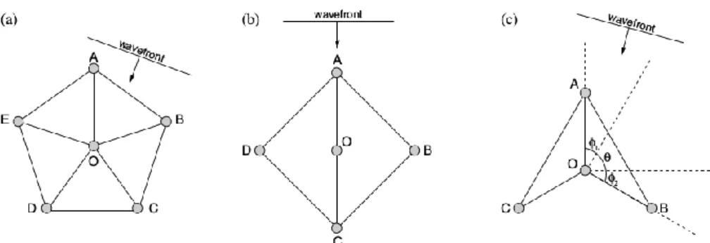
The discretization of the domain is the most important step in the finite element method, since the manner in which the domain is discretized will affect the computer storage requirements, the computation time and the accuracy of the numerical results. The entire domain is subdivided into a number of subdomains, called elements. When the domain is a one-dimensional domain, the elements are short line segments interconnected to form the original line (Fig.3a); for a bidimensional domain, the elements are small triangles and rectangles. The triangular elements are used for irregular regions, instead the rectangular ones are used in the discretization of rectangular regions (Fig.3b). In a three-dimensional domain, the elements are represented by tetrahedral, triangular prisms or rectangular prisms (Fig.3c) (Jin, 2002).
Figure 3: Finite elements: a) one-dimensional, b) two-dimensional, c) three-dimensional (Jin, 2002)
The problem is formulated considering the unknown function at the nodes of each element. More specifically, the one-dimensional element, the line, has two nodes, one at each endpoint; the triangular element has three nodes, the vertices and the tetrahedron four nodes. In the computer code, it is necessary to give a complete description of a node, consisting of the coordinate values of the nodes, the local number that indicates the node position within the element, and the global
24
number, which is used to assign the position within the entire domain. In the discretization we cannot have overlapping or empty places between elements and it is not possible for the vertex of an element to be inside another element. In addition to that, in the definition of the triangular elements, one has to avoid narrow angles, to avoid large computation errors (Jin, 2002). Even if increasing the number and reducing the size of the elements give in principle a more accurate solution, it produces more unknowns and consequently, much computer storage and computation time. Therefore, we can use smaller elements where the solution can have intense variations, and the larger ones where the variation is less accentuated (Jin, 2002).
The second step is the selection of an interpolation function that provides an approximation of the unknown solution within an element. The interpolation can be a polynomial of first, second or higher order; even if higher-order polynomials are very accurate, they result in a more complicated formulation than the lower-order polynomials; for this reason, the simple linear interpolation is widely used. Once the order of the polynomial has been chosen, we can obtain an expression for the unknown solution in an element, e, in the form:
φ̃ = ∑ Ne j eφ j e={Ne}T{φe}={φe}T{Ne} n j=1 (4.1)
where n is the number of nodes in the element, φje is the value of the unknown function φ at node j
of the element, and Nje is the interpolation function for node j. Moreover, the {∙} indicates a column
vector and the superscript T denotes the transpose of the vector. An important characteristic of the interpolation functions is that they are nonzero only within the element, instead they are zero outside this element (Jin, 2002).
The third step is the formulation of the system of equation to use, for instance the Ritz variational or the Galerkin methods. Then, we set up the equations over all elements, to form the system of equations and we apply the required boundary conditions: the Dirichlet boundary condition, which assign a certain value to the function at boundary, or the Neumann condition, which requires the normal derivative of the function to vanish at the boundary (Jin, 2002). The last step is solving the system of equation, as:
[K]{φ}={b} (4.2)
Application of the finite element method to the resistivity problem
Resistivity data are generally interpreted by 1D or 2D models, but considering the complex responses observed in many field environments, it is necessary to obtain 3D interpretation
25
(Pridmore et al., 1981; Sasaki, 1994). Numerical solutions to the bi-dimensional or three-dimensional direct current resistivity problem have been obtained in literature using different numerical techniques, as finite-difference or finite-elements techniques. The finite-difference method has been used by Dey and Morrison (1979) in order to model 2D or 3D structures, while the finite elements method has been applied to 2D resistivity problems by Coggon (1971) and to 3D resistivity problems by Pridmore et al. (1981).
First of all, we have to define the boundary value problem. Following Dey and Morrison (1979), we can write Ohm’s law, that relates the current density J to electric field intensity E, and isotropic conductivity :
J=σE (4.3)
Since the electric field E is conservative, i.e.it is the gradient of the potential u, it is possible to write:
E = −𝛻u (4.4)
If the principle of conservation of charge and the equation of continuity are considered, it can be obtained:
∇J=∂ρ
∂tδ(xs)δ(ys)δ(zs) (4.5)
where is the charge density for a point whose coordinates (x,y,z) are specified in the Cartesian domain by the Dirac delta function.
In this way, we can write eq.4.3 as:
-∇∙σ∇u=∂ρ
∂tδ(xs)δ(ys)δ(zs) (4.6)
where (xs,ys,zs) are the coordinates of the source point of the injected charge. For a point electrode at
the origin (Pridmore et al. ,1981), we can write eq.4.6 as:
-∇∙σ∇u=Iδ(xs)δ(ys)δ(zs) (4.7)
where I is the current in the electrode. This equation is known as the Poisson’s equation (Binley and Kemna, 2005).
In order to obtain numerical solutions for the Poisson’s equation, it is necessary to give some boundary conditions, such as the continuity of the potential φ and the continuity of the component of current normal to the boundary:
26 ∂u
∂n+αu=0 on∂Ω=∂Ωs∪∂ΩI (4.8)
At the air-earth interface, the homogeneous Neumann condition (=0) is applied to avoid current
flow through the boundary along the outward normal n and so 𝜕u
𝜕𝑛 must be zero, whileσ is negligible
in the air (Pridmore et al., 1981).
The finite element method (FEM) is employed to solve the Poisson’s equation with given boundary conditions, following the approach of Rucker (2011). From a general point of view, two approaches can be used for the FEM method: the variational formulation and the weighted residuals. However, it has been demonstrated that for the DC method, the two approaches give the same results (Rücker, 2011) and we choose to work with the method of the weighted residual.
Summarizing shortly the Galerkin method, for a generalized partial differential equation, it is possible to obtain an approximated solution, which solves the equation with a residuum, R, that has to be multiplied by a weighting function, w. In particular, it is possible to write the weighted residual (Rücker, 2011):
∫ wR dΩ=0
Ω
(4.9)
This expression (Eq.4.9) is then applied to Eq.4.7, and after some passages (Rücker, 2011), considering the boundary conditions too, the weak formulation is obtained (Eq.4.10):
∫ σ∇ w∇ udΩ+ ∫ σwαud∂Ω= ∫ w∇∙jdΩ
Ω ∂ΩI
Ω
(4.10)
Dividing the entire domain in a finite number of small subdomains and selecting an interpolation function that provides an approximation of the unknown solution within an element, according to the finite elements method, we can derive an approximated solution for the function u (Eq. 4.11):
u ≈ uℎ = ∑ 𝑁𝑖 ∙ uℎ𝑖
𝑛 𝑖=1
(4.11)
where n is the number of nodes that depends on the element that we choose and N are the interpolation rules for the potential uh in each node.
Applying this approximation (Eq.4.11) to the weak formulation (Eq.4.10), it is possible to write the approximation for the DC problem, as:
27 ∑ uℎ𝑖 𝑁 𝑖=1 (∫ 𝜎∇𝑁𝑗∇𝑁𝑖𝑑Ω + ∫ 𝜎𝛼𝑁𝑗𝑁𝑖𝑑𝜕Ω 𝜕Ω𝐼 Ω ) = ∫ 𝑁𝑗∇ ∙ 𝑗𝑑Ω𝑓𝑜𝑟𝑗 = 1 … 𝑁 Ω (4.12)
Eq.4.12 can be written as a symmetrical system of equations Au=b, dividing the entire domain into C elements, that have a constant conductivity σ(e) and B
1 inner boundaries (see Rücker (2011) for
more details).
Since the Dirac delta function in the source term of DC equation (Eq.4.7) leads to infinite potential gradients at the source position, this singularity can be removed splitting the total potential u, into a primary, up, and a secondary, us, part, as described in Coggon (1971):
u = u𝑝+ u𝑠 (4.13)
The primary potential, up, is caused by the current source in a uniform half-space with the
conductivity σp and since it satisfies the source term, it is possible to write:
∇ ∙ (𝜎𝑝∇u𝑝) = −∇ ∙ 𝑗 (4.14)
The secondary potential us is caused by the inhomogeneity, with the anomalous conductivity σs.
The final formulation is written as:
∇ ∙ (𝜎∇u𝑠) = ∇ ∙ ((𝜎𝑝− 𝜎)∇u𝑝) 𝑖𝑛Ω (4.15)
𝜕u𝑠
𝜕𝑛 + 𝛼u𝑠 = 𝜕u𝑝
𝜕𝑛 + 𝛼u𝑝 = 0 𝑜𝑛𝜕Ω𝐼 (4.16)
Since the system of equation has to be solved for each current source (number of electrodes used) and that the matrix A is symmetrical, sparse, positive definite and square, different numerical methods can be used and generally the conjugate gradient methods are very efficient (Rücker, 2011). I will discuss this method in depth in paragraph 4.5.
4.1.2. Seismic methods: The Fast Marching Method
A wide range of applications requires the development of numerical techniques for tracking moving interfaces or advancing fronts. In particular, in seismic applications, it is essential to compute the first traveltimes. The problem of computing first arrival traveltimes is equivalent to tracking an interface normal to seismic rays (Sethian and Popovici, 1999). Advances in numerical analysis have led to computationally efficient tools for tracking moving interfaces, such as level set methods (Sethian, 1999b). This method is intended to track interfaces whose motion is governed by the Hamilton-Jacobi equation, which is a particular class of first-order hyperbolic partial differential
28
equation (PDE). One important Hamilton-Jacobi equation is the Eikonal equation, which is a first-order nonlinear PDE whose solution tracks the motion of monotonically advancing fronts (Sethian and Popovici, 1999). Several methods have been proposed to solve this equation, among which the most stable and consistent is the Fast Marching Method (FMM), which can be used both for Cartesian domains and for triangulated surfaces (Fomel, 1997; Sethian, 1999a). The FMM is a grid based numerical algorithm that tracks the evolving front along a narrow band of nodes whose values are updated solving the Eikonal equation, using upwind finite-difference approximations of the gradient term (Sethian, 1999a, b; Rawlinson and Sambridge, 2004). The FMM exploits the same idea of the Dijkstra’s method, which is an algorithm for computing smallest cost paths on a network (Sethian and Vladimirsky, 2000) and can be considered a continuous version of Dijkstra’s algorithm (Sethian, 1999a; Bronstein et al., 2008). However, the Dijkstra’s technique, that has the same computational complexity of the FMM, is numerically inconsistent, since, given two points on the graph, it produces the network with minimum length, which may not be optimal (Kimmel and Sethian, 1998, Sethian, 1999b).
We can write a brief description of the FMM. First of all, we can describe the boundary value problem (e.g. the description of an interface that is strictly expanding or contracting) (Sethian, 1999a, b). Consider a closed interface Γ, a boundary, that can be a curve in 2D or a surface in 3D and that separates one region from another. If Γ moves only in one direction (outward or inward) with speed F and has a monotonically increasing or decreasing propagation according to the sign of
F, we can compute the arrival time T(x) of Γ across each point x to track the position of the front
(Fig.4).
Figure 4: Crossing time calculation for an expanding front (Sethian, 1999b)
The equation of the motion of this front can be derived starting from the one-dimensional case, considering that the distance x, is the product between the speed F and the time T (Eq.4.17):
F =𝑑𝑥
29
In multiple dimensions, the equation of motion is given by (Eq.4.18):
|𝛻T|F = 1 (4.18)
in which the arrival time T of the initial position of the front is set to zero. If the speed depends only on the position, x, such equation reduces to a nonlinear first-order PDE, which is known as the Eikonal equation (that is a particular case of the more general Hamilton-Jacobi equation when F depends only on the position x). This equation describes a front that is always expanding or contracting and can be written also as (Eq.4.19):
|∇𝑥T| = 𝑠(𝑥) (4.19)
where s(x) is the slowness, which is the reciprocal of velocity. This equation shows that the gradient of the arrival time surface is inversely proportional to the speed of the front (Rawlinson and Sambridge, 2004).
Since the evolving curve or surface can develop corners (where the evolving interface focuses), rarefaction fans (where it expands) or regions where it changes topology, it is important to deal with these behaviors accurately. The Eikonal equation cannot be easily solved in the presence of high velocity gradients, because the equation requires that gradient to be defined. One way of dealing with this problem is to seek a “weak solution”, that results in a continuous T(x) but not necessarily a continuous gradient (Rawlinson and Sambridge, 2004) and specifically, to construct entropy-satisfying approximations of the gradient term. In order to find this weak solution, a viscous term can be added to the Eikonal equation:
|∇𝑥T| = 𝑠(𝑥) + 𝜀∇𝑥2T (4.20)
where ε is a smoothing parameter. The viscous term added to the Eikonal equation guarantees the solution to be smooth in the entire domain. As ε goes to zero, we find the weak solution that corresponds to the first-arriving wave front. (Sethian, 1999a; Rawlinson and Sambridge, 2004). The same solution can be obtained using the entropy condition (Sethian, 1999a, b): if the boundary curve is imaged as a source for a propagating flame, it will be satisfied the requirement that ‘once a pointburns, it stays burnt’ (Sethian, 1999b). In particular, this entropy condition in this case means that “once a corner has developed, the solution is no longer reversible” (Sethian, 1999b). Consequently, the propagation of a first-arriving wave frontsatisfies an entropy condition because it can only pass through a point once.
The numerical approximation of 𝛻𝑇 that selects the physically correct viscosity weak solution, is an upwind finite difference scheme, that uses upwind gradient operators, which take into account the
30
direction of information flow. In fact, in order to approximate the Eikonal equation, we can discretize the domain into a collection of grid points. In this way, we can define the gradient operators (using the Taylor expansion) and use the forward, D+, and backward, D-, operators
(Sethian, 1999a; Rawlinson and Sambridge, 2004):
[max(Da-xT,-Db+x𝑇,0)2+max(Dc-yT,-Dd+y𝑇,0)2+max(De-zT,-Df+z𝑇,0)2]
ijk 1/2
=si,j,k (4.21)
where T is the traveltime, (i,j,k) are grid index variables in (x,y,z), sijk is the slowness and the integer
variables a, b, c ,d, e, f define the order of accuracy of the upwind finite-difference operator used in each of the six cases (Rawlinson and Sambridge, 2004). In particular:
D1-xTi=Ti-Ti-1
∂x (4.22)
where δx is the grid spacing in x. The structure of Eq. 4.21 suggests that the information propagates from smaller values to larger values of traveltimes. To achieve this result, the FMM constructs traveltime T in a downwind fashion using the upwind known values and employing a narrow band approach (Rawlinson and Sambridge, 2004). In particular, the points that belong to the existing front are firstly freezed and the points around the existing front are put in a narrow band that marches forward. The essential characteristic of the algorithm is the selection of which gridpoint in the narrow band will be updated. The algorithm proceeds as follows: first, we tag points that have their values correctly calculated as alive; points that are one grid point away, within the narrow band and that have trial values, as close, and points that have no value calculated as far (Fig.5).
Figure 5: The principle of the method (Rawlinson and Sambridge, 2004)
The trial values are calculated using the upwind scheme with alive points only, that lie upwind of the close points. We can describe the loop with the following operations:
31
- identify the close point with minimum traveltime and tag it as an alive point; - tag all neighbours of this point as close and compute their traveltimes; - repeat this process to calculate the traveltimes for all gridpoints.
A heap sort algorithm (Cormen et al., 2001) is used to rapidly locate the gridpoint in the narrow band with minimum traveltime. The algorithm works because the process of recomputing the T values at upwind neighboring points cannot yield a value smaller than any of the accepted points. The scheme is very fast and solves the equation in O (N logN) steps, where N is the number of total points in the grid. The Eikonal equation is solved at each grid point and the accuracy of the method is dependent on the mesh size and on the order of the finite-difference approximation that is used (Sethian and Popovici, 1999; Rickett and Fomel, 2000).
The Fast Marching Method on triangulated surfaces
The FMM, in the attempt to solve the Eikonal equation and to determine the propagation of first-arrival seismic wave fronts given a slowness distribution, was focused in the first applications (Sethian and Popovici, 1999; Rickett and Fomel, 2000) on regular rectilinear 2D grids. Then, it was extended to unstructured 2D triangular grids thanks to Kimmel and Sethian (1998), Sethian (1999a, b) and Rawlinson and Sambridge (2004). Fomel (1997) obtained an equivalent result using a different formulation of the problem and in particular in terms of the Fermat’s principle in the case of eikonal solvers. This approach was used also in Lelièvre et al. (2011).
Following the procedure of Fomel (1997) updated in Lelièvre (2011), we can consider the triangle ABC (Fig.6). The traveltimes in A and B are tA and tB respectively and are known quantities since
they have been calculated in the previous step of the algorithm and the problem is to calculate the traveltime in node C. The assumption is that the wave fronts that travel through the cell are linear and that any ray travelling through the cell is also linear (Lelièvre et al., 2011). In the figure, ξ is a normalized distance along the line from A to B and ρ is the distance from node C to a point ξ on line AB (as in Fig.6). In the end, ξ0 is the normalized projection of node C on line AB and ρ0 is the
32
Figure 6: Triangular cell ABC. Wave fronts are represented as thin grey lines, instead the ray throught node C is represented as a thick grey line that is perpendicular to wave fronts
The traveltime in C can be written as:
tC(ξ)=t(ξ)+sρ=tA+uξ+s√c2(ξ-ξ
0)+ρ02 (4.23)
where u=tB-tA with tB>tA (the front passes firstly through A and then through B), c is the length of
line AB (since ξ is a normalized distance) and s is the slowness of the triangular cell.
The term tA+uξ is the linearly interpolated traveltime at point ξ on line AB and sρ is the traveltime
for the path from that point to node C, calculated as slowness multiplied by distance, following Pythagora’s theorem considering the triangle Cξ0ξ. Since Fermat’s principle states that light
traveling between two points always chooses the quickest path, in this case, the ray to C should correspond to a local traveltime minimum. Therefore, we search accordingly for the value of ξ that minimizes the traveltime through the cell and therefore, equation 4.23.
After some algebra, Lelièvre et al. (2011) found the simple expression for tC:
tC=tA+uξ0+wc-1ρ0 (4.24)
that is equivalent to the one derived by Fomel (1997), where w is the square root of:
w2=s2c2-u2≥0 (4.25)
The traveltime calculated in this way corresponds to a wave transmitted through the cell, but considering also the traveltimes associated to head waves along sides AC and BC, as in Podvin and Lecomte (1991):
tC=min(tA+uξ0+wc-1ρ