Sede Amministrativa
Università degli Studi di Sassari
Dipartimento di Scienze della Natura e del TerritorioSede Consorziata
Università degli Studi di Napoli
Dipartimento di Scienze della Terra, dell’Ambiente e delle Risorse
Indirizzo
Sc
ienza e Tecnologia dei Minerali e delle Rocce di Interesse
Industriale
XXVII CICLO
MINERALOGICAL AND GEOTECHNICAL CHARACTERIZATION OF
STRUCTURALLY COMPLEX FORMATIONS INVOLVED IN THE SLOW
MOVING LANDLIDES AFFECTING THE SOUTHERN APENNINE
CARATTERIZZAZIONE MINERALOGICA E GEOTECNICA DELLE FORMAZIONI STRUTTURALMENTE COMPLESSE COINVOLTE NEI LENTI MOVIMENTI DI
VERSANTE DELL’APPENNINO MERIDIONALE
Direttore
Prof. Marco Curini Galletti
PhD Student Tutor
Dott.ssa Mara Cesarano Prof. Piergiulio Cappelletti
Co-tutors
Prof. Calcaterra D., Prof. De Vita P., Dott. Fiore S., Prof. Ramondini M., Prof. de’ Gennaro M.
UNIONE EUROPEA FONDO SOCIALE EUROPEO
TABLE OF CONTENTS
ABSTRACT ______________________________________________________ 5 RIASSUNTO _____________________________________________________ 6 INTRODUCTION _________________________________________________ 7 CHAPTER 1 _____________________________________________________ 9 LANDSLIDES: TYPES AND PROCESSES ____________________________ 9 LANDSLIDE CLASSIFICATION _________________________________ 11 MAIN TRIGGERING FACTORS _________________________________ 18 SLOW-MOVING LANDSLIDES IN THE SOUTHERN APENNINES ___ 20 CHAPTER 2 ____________________________________________________ 23 CLAY MINERALS _______________________________________________ 23 ORIGIN OF CLAY MINERALS __________________________________ 23 GENERAL STRUCTURAL FEATURES OF CLAY MINERALS ________ 26 CLAY MINERAL PROPERTIES __________________________________ 27 CLAY MINERALS CLASSIFICATION ____________________________ 30 1:1 LAYER TYPE _____________________________________________ 31 2:1 LAYER TYPE (high charge ~1) _______________________________ 33 2:1 LAYER TYPE (low charge <1) ________________________________ 33 MIXED LAYERS ______________________________________________ 36 THE MIXED LAYER ORDERING ________________________________ 37 CHAPTER 3 ____________________________________________________ 40
RELATIONSHIPS BETWEEN SLOW-MOVING LANDSLIDES AND MINERALOGY OF THE STRUCTURALLY COMPLEX FORMATIONS __ 40
STRUCTURALLY COMPLEX FORMATIONS: ESU (1977)
CLASSIFICATION _____________________________________________ 40 PREVIOUS STUDIES ON SLOW-MOVING LANDSLIDES IN
SOUTHERN ITALY ____________________________________________ 42 BISACCIA LANDSLIDE (AVELLINO PROVINCE, SOUTHERN ITALY) __ 42 AGNONE LANDSLIDE (ISERNIA PROVINCE, SOUTHERN ITALY) ____ 44 CHAPTER 4 ____________________________________________________ 46 THE TERMINI NERANO LANDSLIDE _____________________________ 46 GEOLOGICAL SETTING _______________________________________ 46
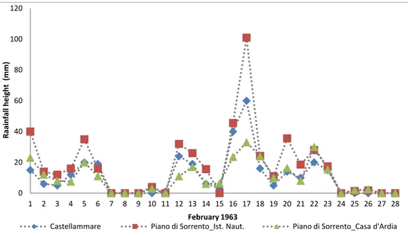
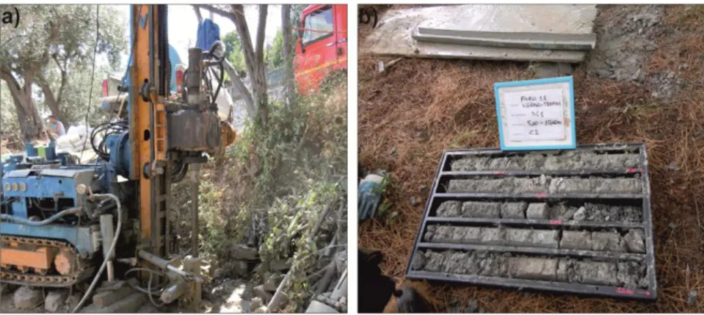
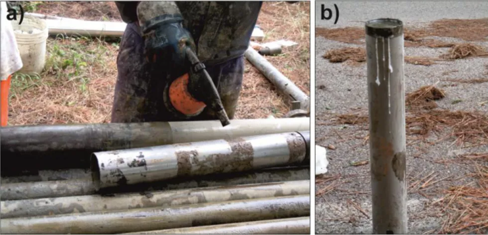
HISTORICAL LANDSLIDES IN THE STUDIED AREA _____________ 48 1963 LANDSLIDE: MAIN FEATURES ____________________________ 49 CHAPTER 5 ____________________________________________________ 53 ANALYTICAL METHODS AND TECHNIQUES ______________________ 53 GEOLOGICAL SURVEY AND SAMPLING STRATEGY _____________ 53 GEOELECTRICAL PROSPECTING ______________________________ 56 AERIAL PHOTOGRAPHIC INTERPRETATION ____________________ 58 MINERALOGICAL AND CHEMICAL ANALYSES __________________ 58 X-RAY POWDER DIFFRACTION ANALYSIS ______________________ 59 X-RAY FLUORESCENCE (XRF) ________________________________ 66 SCANNING ELECTRON MICROSCOPE (SEM) ____________________ 66 GEOTECHNICAL ANALYSES __________________________________ 67 SPECIFIC GRAVITY TEST _____________________________________ 67 GRAIN SIZE ANALYSIS AND DISTRIBUTION _____________________ 68 ATTERBERG LIMITS _________________________________________ 71 DIRECT SHEAR STRESS TEST _________________________________ 72 REOLOGYCAL ANALYSIS _____________________________________ 75 CHAPTER 6 ____________________________________________________ 78 RESULTS ______________________________________________________ 78 GEOLOGICAL SURVEY AND SAMPLING ________________________ 78 GEOLOGY AND STRATIGRAPHY OF THE AREA __________________ 78 GROUND MONITORING LANDSLIDE ___________________________ 83 GEOELECTRICAL ANALYSES __________________________________ 85 AERIAL PHOTO ANALYSIS ____________________________________ 88 MINERALOGICAL CHARACTERIZATION _______________________ 91 XRPD MINERALOGICAL ANALYSIS _____________________________ 91 CHLORITE-KAOLINITE TEST __________________________________ 94 ORIENTED AGGREGATES ____________________________________ 95 QUANTITATIVE ANALYSES ____________________________________ 99 CHEMICAL ANALYSES-XRF __________________________________ 105 SEM ANALYSES ____________________________________________ 107 GEOTHECNICAL CHARACTERIZATION _______________________ 114 GRAIN SIZE ANALYSES ______________________________________ 114 SPECIFIC GRAVITY TEST ____________________________________ 116 ATTERBERG LIMITS ________________________________________ 117 USCS CLASSIFICATION _____________________________________ 120 DIRECT SHEAR TEST _______________________________________ 123 FLOW BEHAVIOUR CHARACTERIZATION _____________________ 124 RHEOLOGICAL ANALYSES ___________________________________ 124 CHAPTER 7 ___________________________________________________ 128
DISCUSSION AND CONCLUIONS ________________________________ 128 ACKNOWLEDGEMENTS ________________________________________ 134 REFERENCES _________________________________________________ 135 APPENDIX 1: XRPD PATTERNS _________________________________ 145
ABSTRACT
Slow-moving landslides affect several areas in the Apennine chain (Italy). They involve sedimentary rocks that are weathered in the more surficial parts. The occurrence of weathering-related clay minerals (e.g. smectites) able to trap high amounts of water, is generally considered a predisponding factor for these landslides. The main goal of this research is to verify this statement, carrying out a mineralogical-geotechnical characterization of clayey rocks occurring in the Termini-Nerano slow-moving landslide (Massalubrense, Italy).
The mineralogical composition of soils involved in the landslide was evaluated on several drill-core samples from the studied area, by using quantitative X-ray powder diffraction analyses, calibrated through chemical bulk rock analyses. Clay separates allowed to determine the composition of the clay fraction. The results confirm that the total amount of clays, and specifically the smectite amount in mixed layers I/S, could have played a role in the landslide development. However, relationships between mineralogical composition and weathering zones in the soil have not been observed.
Geotechnical analyses attested that the mechanical behavior of the material involved in the landslide depends on the amount of granulometric clay fraction in the samples, but, differently from what expected, no correlations were observed between this behavior and the measured amounts of smectite or mixed layers I/S.
Key words: slow-moving landslides, mineralogical analyses, geotechnical tests,
RIASSUNTO
Le frane a cinematica lenta sono particolari movimenti di versante che avvengono in diverse zone dell’Appennino Meridionale, e coinvolgono rocce sedimentarie particolarmente alterate, contenenti silicati. La presenza di minerali associati a profili di alterazione supergenica (es. smectite) favorirebbe l’innesco di questi fenomeni franosi, per la loro capacità di adsorbire elevati quantitativi di acqua. L’obiettivo del presente lavoro è verificare tale assunzione attraverso la caratterizzazione mineralogico-geotecnica dei terreni argillosi coinvolti nella frana di Termini Nerano (Massalubrense, Italia).
La composizione mineralogica dei materiali coinvolti nella frana è stata valutata su campioni estratti da sondaggi eseguiti nell’area di studio, mediante analisi diffrattometriche ai raggi X (su tal quale e frazione argillosa), calibrate attraverso analisi chimiche. I risultati confermano che la quantità delle fasi argillose, in particolare di smectite presente in strati misti I/S, potrebbe aver influenzato lo sviluppo del fenomeno franoso, anche se la composizione mineralogica delle rocce non è in questo caso direttamente correlabile ad una presenza di orizzonti di alterazione nel sottosuolo.
Analisi geotecniche hanno confermato che il comportamento meccanico del materiale dipende dalla quantità granulometrica di frazione argillosa che presenta, ma non dalla quantità di smectite o strati misti I/S che contiene.
Parole chiave: Lenti Movimenti di Versante, analisi mineralogiche, analisi
INTRODUCTION
The subject of this PhD-thesis is the characterization of a slow-moving landslide, which in the past underwent paroxysmal evolution. The aim of the study is to verify whether it is possible to correlate mineralogical features and geotechnical parameters of the clayey materials involved in these phenomena.
Slow-moving landslides are down-slope movements of soils and rocks characterized by slow rate of displacement. External events, such as long duration rainfalls and earthquakes, can trigger paroxysmal events, increasing velocity of the moving mass and consequently making it more dangerous. These landslides are usually associated with highly weathered part of slopes, constituted by rock generally called “structurally complex formations” and defined, according to Esu (1977), as highly tectonized clayey formations, provided with a pervasive scaly structures. The author (Esu, 1977) subdivided them into two groups, on the basis of their lithological complexity.
As a matter of fact, it is generally assumed that highly weathered rocks are characterized by great amount of expandable clays which seems to be directly related to the shear strength of rock material. In fact the presence of expandable clays (e.g. smectite) should favor the water absorption in the rocks, thus promoting the decrease of their shear strength (Taylor & Cripps, 1987).
In geotechnical engineering, the relationship between the amount of water in a soil and its mechanical behavior is evaluated by the Atterberg Limits. The latter represent a basic measure of the critical water contents of a fine grained soil, at which the physical properties of the material changes (e.g. the water content at the transition from the plastic to liquid state). These measures are generally used to obtain indirect information about the mineralogical nature of the analyzed material, through, for example, the so called Casagrande chart, which allow to determine the types of clays occurring in a rock by comparing Plastic index (IP) and Liquid Limit (WL).
Bearing this in mind, the main aim of this thesis was to test the benefits and the limits of the empirical mineralogical-geotechnical correlation, carrying out direct mineralogical analyses on the same samples analyzed to determine the geotechnical properties, and comparing the results.
The work was conducted on samples extracted from three boreholes drilled within the 1963 Termini Nerano landslide, occurred in the Sorrento peninsula, and involving three different villages: Termini, Nerano and Marina del Cantone, where several infrastructures where damaged. The paroxysmal phenomenon was triggered by a long duration rainfall.
The material mainly involved in the landslide consists of a Miocene aged flysh, called “Arenarie di Termini” Formation, which in turn is made up of sandstones, more or less rich in calcareous clasts and clays, and has the typical characteristics of the above cited “structurally complex formations”.
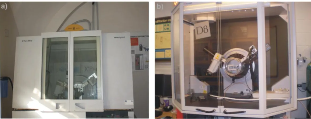
XRPD analyses on several samples were carried out to directly evaluate the mineralogical composition of the material involved in the landslide. Specific analyses on clay fraction were also performed to deeply investigate the nature of
possible expandable clays occurring in the rock. Geotechnical analyses (Atterberg Limits, shear tests, specific gravity tests and grain size distribution analyses) instead, allowed to evaluate the physico-mechanical properties of the landslide. The results were compared and discussed on the basis of the previous studies on Termini Nerano landslide and of other studies on slow-moving landslides in southern Italy.
CHAPTER 1
LANDSLIDES: TYPES AND PROCESSES
Landslides are defined as movements of a mass of rock, debris or earth down slope (Cruden, 1991).
In 1978 Varnes followed by Cruden & Varnes (1996), proposed an accurate description of landslide features (Fig. 1.1). In Table 1.1 a description of each part is reported (Cruden & Varnes, 1996).
Table 1.1 Definitions of landslide features (Varnes, 1978; Cruden & Varnes, 1996). ID
Number Name Definition
1 Crown Practically undisplaced material adjacent to highest parts of main scarp
2 Main Scarp
Steep surface on undisturbed ground at upper edge of landslide caused by movement of displaced material (13) way from undisturbed ground; it is visible part of surface of rupture (10) 3 Top Highest point of contact between displaced material (13) and
main scarp (2).
4 Head Upper parts of the landslide along contact between displace material and main scarp (2)
5 Minor Scarp Steep surface on displaced material of landslide produced by differential movements within displaced material.
6 Main body Part of displaced material of landslide that overlies surface of rupture between main scarp (2) and toe surface of rupture (11) 7 Foot Portion of landslide that has moved beyond toe of surface of
rupture (11) and overlies original ground surface (20) 8 Tip Point on toe (9) farthest from top (3) of landslide. 9 Toe Lower, usually curved margin of displaced material of a
landslide, most distant from main scarp (2) 10 Surface of
rupture
Surface that forms (or that has formed) lower boundary of displaced material (13) below original ground surface (20). 11 Toe Surface
of rupture
Intersection (usually buried) between lower part of surface of rupture (10) of a landslide and original ground surface (20). 12 Surface of
separation
Part of original ground surface (20) now overlain by foot (7) if landslide.
13 Displaced material
Material displaced from its original position on slope by movement in landslide; it forms both depleted mass (17) and accumulation(18)
14 Zone of depletion
Area within which displaced material (13) lies below original ground surface (20).
15 Zone of accumulation
Area within which displaced material lies above original ground surface (20)
16 Depletion Volume bounded by main scarp (2), depleted mass (17) and original ground surface (20).
17 Depleted mass
Volume of displaced material that overlies surface of rupture (10) but underlies original ground surface (20).
18 Accumulation Volume of displaced material (13) that lies above original ground surface (20).
19 Flank
Undisplaced material adjacent to sides of surface of rupture; compass directions are preferable in describing flanks, but if left and right are used, they refer to flanks as view from crown. 20
Original ground surface
LANDSLIDE CLASSIFICATION
Several kinds of landslide classifications have been proposed in the years, in which different types of parameters are considered. In 1985, Sassa proposed a landslides classification on the basis of the geotechnical parameters of the involved material (e.g. granulometric features, type of shear stress). Pearson & Costa (1987) focused their attention on the rheological features of water flows (e.g. flow velocity and sediment concentration). Hutchinson (1988) based the classification on the main geotechnical and morphological parameters of the material involved in the movement.
The most complete classification of landslides was firstly proposed by Varnes in 1978, and lately revisited by Cruden & Varnes (1996).
This classification considers several parameters:
Material
Water content
Type of movement
Landslide activity
Rate of movement
A description of these parameters is reported below.
MATERIAL: according to the Cruden & Varnes classification (1996) the material involved in a landslide can be subdivided in two main groups: rock and soil. Rock is defined as hard or firm mass that was intact and in its natural place before the initiation of movement, or soil, an aggregate of solid particles, minerals or rocks, that either was transported or was formed by the weathering of rock in place.
Soil is subdivided into two other categories: earth and debris. In case of earth, more than 80% of material consists of particles whose size is smaller than 2 mm. In case of soil, a variable range of material, from 20 to 80% is characterized by particles whose size is larger than 2 mm, whereas the remainder is smaller.
WATER CONTENT: considering the Cruden & Varnes classification (1996) the material involved into the landslides is classified on the basis of its amount of water:
Dry: no moisture visible
Moist: contains some water but no free water; the material may behave as a plastic solid but does not flow
Wet: contains enough water to behave in part as a liquid, has water flowing from it, or supports significant bodies of standing water
Very wet: contains enough water to flow as a liquid under low gradients.
TYPE OF MOVEMENT: the kinematics of a landslide is the most important parameter for its classification. Cruden & Varnes (1996) defined:
Fall: the movement starts with the detachment of soil or rock from a steep slope along a surface on which little or no shear displacement takes place. The involved material descends mainly through the air by falling, bouncing or rolling.
Specifically, free falls usually happen when the slopes angle exceeds 76°, rolling usually happens when slope angle is below 45° are reached, bouncing happens when the slope angle is lower than 45°. The rate of movement varies from very rapid to extremely rapid.
Topple: this movement is defined as a forward rotation out of the slope of a mass of soil or rock around a point axis below the center of gravity of the displaced mass. Toppling is sometimes driven by the gravity exerted by material upslope of the displaced mass, as well as by water or ice leak into cracks in the rock mass. The rate of movement varies from extremely slow to extremely rapid. Flexural topple occurs if the rock mass is characterized by the presence of one preferred discontinuity.
Slide: a slide is a down-slope movement of soil or rock mass, occurring mainly on surfaces of rupture or on relatively thin zones of intense shear strain. It is possible to distinguish between rotational slide and transitional slide, on the basis of the surface of rupture shape.
Specifically, a rotational slide moves along a surface of rupture that is circular or cycloidal concave. In this case the displaced mass may move along the surface with little internal deformation. If the movement extends for a considerable distance along the slope, which is perpendicular to the direction of motion, the surface of rupture may be roughly cylindrical.
Rotational slides usually occur in homogeneous material. The rotation in the rotational slides tends to restore the displaced mass to equilibrium.
In case of translational slides the mass displaces along a planar or undulating surface of rupture, sliding out over the original ground surface. Translational slides generally are relatively shallower than rotational slides. In the case of translational landslides the movement continues unchecked if the surface of the separation is particularly inclined.
Spread: this kind of movement is an extension of a cohesive soil or rock mass combined with a general subsidence of the fractured mass of cohesive material into softer underlying material. The surface of rupture is not a surface of intense shear. Spreads may result from liquefaction or flow of softer materials. The cohesive materials usually subside, translate, rotate, disintegrate, or liquefy and flow.
Flow: a flow is a spatially continuous movement in which surfaces of shear are short-lived, closely spaced, and usually not preserved. The distribution of velocities in the displacing mass resembles the one which characterizes viscous liquid. The lower boundary of the displaced mass can be a surface along which an appreciable differential movement has taken place or a thick zone of distributed shear. The differentiation of slide and flow depends on the water content, as well as the mobility and the evolution of the movement. An evolution from slide movement to flow is possible if the amount of water increases, as well as the
cohesion decreases. The transition also occurs when slide encounters steeper slopes.
On the basis of the involved material, Varnes (1978) and Hungr et al. (2001) distinguished the following types of flows: rock flow, rock avalanche, debris flow, debris avalanche and earth flow. Specifically, rock flow is a flow movement in bedrock (Varnes, 1978); rock avalanche is an extremely rapid, massive, flow-like movement involving fragment of rock from a large rock slide or rock fall (Hungr et al., 2001); debris flow is a very rapid to extremely rapid flow of saturated non plastic debris in a step channel (Hungr et al., 2001); debris avalanche is a very rapid to extremely rapid shallow flow of partially or fully saturated debris on a steep slope without confinement in a established channel (Hungr et al., 2001); earth flow is a rapid or slower intermittent flow like movement of plastic clayey earth (Hungr et al. 2001).
Figure 1.2 Landslide types of movements (Cruden & Varnes, 1996).
On the basis of what written above, each landslide can be classified considering both the type of movement and the involved material (Table 1.2).
Table 1.2 Classification of Slope Movements (Cruden & Varnes, 1996). Type of material
Type of movement Bedrock Predominantly Coarse Soil Predominantly Fine Soil
Fall Rock Fall Debris Fall Earth Fall
Topple Rock
Topple Debris Topple Earth Topple
Slide Rock Slide Debris Slide Earth Slide
Spread Rock Spread Debris Spread Earth Spread
Flow Rock Flow Debris Flow Earth Flow
LANDSLIDE ACTIVITY: the state of activity as well as the distribution of activity and the style of activity gives information about the age and the repetition of movements of landslides.
Specifically, the state of activity describes what is known about the timing of movement, the distribution of activity describes where the landslide is moving and the style of activity indicates the manner in which different movements contribute the landslide (Cruden & Varnes, 1996).
On the basis of the state of activity, landslides are classified in:
Active: when landslides are currently moving, including first time movements and reactivations.
Reactived: when landslides are again active after having been inactive. They usually move on pre-existing shear surfaces characterized by about residual strength as defined by Skempton (1970), or ultimate strength as defined by Krahn & Morgenstern (1979). The shear strength of the rupture surface allows to distinguish reactive slides from active which are characterized by peak values. Suspended: this term is used to describe landslides that have moved within the last annual cycle of season but that are not moving at present (Varnes, 1978).
Inactive: landslides whose last movement has been dated one annual cycle of season before. Inactive slides are defined “dormant”, if the movement remains apparent, and “abandoned” if the river that erodes the toe of the moving slope changes course, as defined by Hutchinson (1973). Inactive slides are defined “stabilized”, if the toe of the slope has been protected against erosion by natural or artificial remedial measures. Ancient landslides are inactive landslides, which remain visible in the landscape for thousands of years after they have moved. Relict: they are currently inactive landslides, developed under different geomorphic and climatic conditions.
Figure 1.3 Landslide state of activity: 1) active slide; 2) suspended slide; 3) re-activated
slide; 5) dormant slide; 6) abandoned slide; 7) stabilized slide; 8) relict slide. After WP/WLI (1993).
On the basis of the distribution of activity, landslides are classified as:
Advancing: if the surface of rupture is extending in the direction of movement. Retrogressive: when the surface of rupture is extending in the direction opposite to the movement of the displaced material.
Widening: when the surface of rupture is extending at one or both lateral margins of the landslide.
Enlarging: when the rupture surface of the landslide is extending in two or more directions.
Diminishing: when the volume of an active slide decreases with time.
Confined: if there is a scarp, but not a visible rupture surface at the foot of the displaced mass.
Moving: when the displaced material continues to move without any visible change in the rupture surface as well as in volume of the displaced material.
Figure 1.4 Landslide distribution of activity: 1) advancing slide; 2) retrogressive
slide; 3) enlarging slide; 4) diminishing slide; 5) confined slide; 6) moving slide; 7) widening slide. After WP/WLI (1993).
On the basis of the style of activity, landslides are classified in:
Complex: the landslide exhibits at least two types of movement (e.g. falling, toppling, sliding, etc.) in sequence.
Composite: the landslide simultaneously exhibits at least two types of movement in different parts of the displacing mass.
Successive: the landslide is the same as a nearby, earlier landslide, but does not share displaced material or rupture surface with it.
Single: the landslide is a single movement of displaced material.
Multiple: the landslide shows repeated development of the same type of movement.
Figure 1.5 Landslide style of activity: 1) complex slide; composite slide; 3)
successive; 4) single slide; 5) multiple slide. After WP/WLI (1993).
RATE OF MOVEMENT: the rate of movement represents the most important parameter in the landslides hazard evaluation. A first velocity scale was proposed by Varnes in 1978, successively revisited in 1996 as shown in Figure 1.6.
In this scale, seven classes are established: from extremely low (15 mm/year) to extremely rapid >5 m/s. For each class, a description of the entity of the damage is reported. In fact, small rapid debris avalanche can cause total destruction as well as loss of life. Vice versa, large slope movements, characterized by low velocity, can have less serious effects, only damaging infrastructures or buildings. This means that velocity can influence the risk related to a landslide more than the amount of the involved material.
Figure 1.6 Landslide velocity classes (Cruden & Varnes, 1996).
MAIN TRIGGERING FACTORS
Cruden & Varnes (1996) also gave information about the main causes of landslides. After the authors, the main causes for triggering landslides are:
Increased shear stress: it can be related to removal of lateral support, imposition of surcharges, transitory stresses resulting from explosion or earthquakes and finally uplift or tilting of the land.
Low strength: it may be associated with the presence of discontinuities within soil or rock mass as well as water infiltrations.
Reduced material strength: this phenomenon mainly affects clays, which are considered particularly prone to weathering processes. Rocks can be disintegrated because of cycles of freezing and thawing.
Successively Highland & Bobrowsky (2008) subdivided the main causes for landslides triggering in two main categories: natural causes and human causes.
Natural causes are water, seismic activity and volcanic activity. Saturation of slopes because of rainfall events, snowmelt, changes in ground water levels can cause the decreasing of shear strength of involved material. Earthquakes in landslide-prone areas increase the likelihood that landslides will occur because of ground shaking and consequently liquefaction phenomenon, or dilation of soil material which favours the water infiltration. Volcanic eruption can also cause landslides because the lava melts snow rapidly by triggering typical phenomenon called lahar. In addition landslides, rockslides and debris avalanches can affect young volcanic edifices, which are unconsolidated as well as characterized by weak structures.
Human causes: the most common are the artificial modification of drainage pattern, the vegetation removal and the destabilization of slopes.
Also building activity in landslide-prone areas favours landslide triggering.
Table 1.3 Landslide causes (Cruden & Varnes, 1996). Geological causes
1 Weak materials 2 Sensitive materials 3 Weathered materials 4 Sheared materials
5 Jointed or fissured materials
6 Adversely oriented mass discontinuity (bedding, schistosity, etc) 7
Adversely oriented structural discontinuity (fault, uncoformity, contact, etc)
8 Contrast in permeability
9 Contrast in stiffness (stiff, dense material over plastic materials) Geomorphological causes
1 Tectonic or volcanic uplift 2 Glacial rebound
3 Fluvial erosion of slope toe 4 Wave erosion of slope toe 5 Glacial erosion of slope toe 6 Erosion of lateral margins
7 Subterranean erosion (solution, piping) 8 Deposition loading slope or its crest
9 Vegetation removal (by forest fire, drought). Physical causes
1 Intense rainfall 2 Rapid snow melt
3 Prolonged exceptional precipitation 4 Rapid drawn down (of floods and tides) 5 Earthquakes
6 Volcanic eruption 7 Thawing
8 Freeze and thaw weathering 9 Shrink and swell weathering Human causes
1 Excavation of slope or its toe 2 Loading of slope or its crest 3 Drawdown (of reservoirs) 4 Deforestation
5 Irrigation 6 Mining
7 Artificial vibration
SLOW-MOVING LANDSLIDES IN THE SOUTHERN APENNINES
The geological and geomorphological features of Southern Apennines (Italy) favour the occurrence in the chain of particular types of landslides called “Slow-moving landslides”. In fact, these phenomena are widely diffused in flyschoid rocks that are characteristic of this mountain chain.
Slow-moving landslides usually start as slow roto-translational slides (Cruden & Varnes, 1996), and evolving into fast flows after triggering events such as long duration rainfalls and earthquakes.
These are considered as a very dangerous natural hazard, because of their wide distribution and also because of the damages that cause to structures and infrastructures (Picarelli & Russo, 2004; Cascini et al., 2005; Mansour & Morgenstern, 2011). The displacement rate is so slow (some mm to 1/2 m per year), that very long term monitoring is required for a satisfactory evaluation of the kinematics (Mansour & Morgenstern, 2011), but long duration rainfalls and earthquakes can steeply increase the Slow Moving Landslides rate of movement from few mm (to some 1/2 mm per year), up to 50 cm/hour - 5 m/day, making them more dangerous.
The paroxysmal activation of large Slow-moving landslides in Southern Apennine is associated to both rain-falls and earthquakes (Calcaterra et al. 2007). Examples of earthquakes-triggered landslides are the Calitri (province of Avellino) and Bisaccia (province of Avellino) landslides, whereas the Moio della Civitella (province of Salerno) and Agnone (province of Isernia) landslides represent two examples of rainfall triggered landslides.
Calitri and Bisaccia landslides were both triggered by the earthquake, occurred in Irpinia (province of Basilicata) in 1980. Although this earthquake represents one of the most destructive events that affected Southern Italy (Cotecchia & Del Prete, 1984; Carrara et al., 1986; Cotecchia, 1986), by some authors the destructive power of the related landslides has been locally considered higher (Picarelli & Urcioli, 1993).
The Calitri landslide, located along the left valley side of the Ofanto River (Avellino province, Southern Italy), is classified as a deep-seated slow moving slide; its main scarp developed in correspondence of the old town, whereas a shallow mudslide involves the middle-lower portion of the slope, going down to the Ofanto River (Calò, 2009). In the same area, other earthquakes triggered several other landslides in the past (Martino & Scarascia Mugnozza, 2005) (Table 1.4).
Table 1.4 Synthesis of seismic events triggering landslides for Calitri town (By Martino & Scarascia Mugnozza, 2005).
Year* E.I. E.E.M. L.I. Damage and ground effects L.A. Causalities
1561 IX-X 6.4 VII
Collapse of the Castle Tower and of the Chiesa Madre di S. Canio cathedral; damage to all houses.
Unrep. 0 1688 XI 6.7 VIII Damage of residential buildings;
failures at the Castel. Poss. Unrep. 1689 Und. Und. Und.
Collapse of the residential buildings; damaged by previous foundation instabilities
Poss. 6
1692 Und. Und. Und.
Collapse of the residential buildings failures at the S. Canio cathedral; destruction of the Castle
Poss. few
1694 X-XI 6.9 XI
Collapse of the Castle Tower and of the Chiesa Madre di S. Canio cathedral; all residential buildings were damaged.
Poss. Castle inhabitants 1805 VI-VII Und. Und. Ground cracks (Vallone Monaci) and
gas exhalations Unrep. 0
1840 N.E. N.E. N.E. Damage to the S. Canio Cathedral
due to foundation instabilities. Rep. Unrep. 1851 X 6.4 VI Damage to buildings a well as
ground effects were not reported. Unrep. Unrep. 1882 N.E. N.E. N.E.
Demolition of the S. Canio Cathedral because of failure appearing after its 1840 restoration and reconstruction.
Rep. Unrep.
1893 N.E. N.E. N.E.
Demolition of the S. Michele Arcangelo Church, located in the Torre district, because of foundation damage.
Rep. Unrep.
1910 XIII-IX 5.7 IX Damage to residential buildings due
to fall of ruins from the Castle wall. Unrep. 40 1923 VI-VII 4.7 IV-V Damage to buildings as well as
ground effects were not reported. Unrep. Unrep. 1930 X 6.7 VIII Damage to buildings as well as
ground effects were not reported. Unrep. 0
1951-1952 N.E. N.E. N.E.
Damage and destruction of structures in the Torre district due to landslide movements.
Rep. 1
1980 X 6.9 VIII
Landslide activation; destruction of buildings all along the Torre street, De Sanctis street and Matteotti Main street; damage all over the Torre and Piano S. Michele districts; ground cracks in the sorts field plain and mobilization of an earth flow from the sports field plain of the
Rep. 12
Notes: E.I.= Epicentral intensity; E.E.M.=Equivalent epicentral magnitude; L.I.=Local intensity; L.A.= Landslides activation; Und=Undefined; N.E.=No earthquake; Unrep.= Unreported; Rep.=Reported; Poss.= Possible.
The 1980 Calitri landslide, which represents the last event affecting the town, caused the formation of a great number of cracks as well as failures in several areas along the slope (Martino & Scarascia Mugnozza, 2005). Geological surveys in the area (in 2005 and 2009) detected a deep slow moving slide, which is subject to temporary accelerations (Martino & Scarascia Mugnozza, 2005).
The town of Bisaccia is located 24 km north of the epicenter of the Irpinia 1980 earthquake (Parise & Wasowski, 1999). Here, a deep seated gravitational movement was reactivated by this seismic event (Parise & Wasowski, 1999). The mass movement occurred in correspondence of two valleys called Vallone dei Corvi and Vallone Ferrelli, already affected by seismic-induced landslides before the 1980 event. Landslides have been recorded here from 1954 to 1995. Few differences characterize the landslides in the mentioned areas: flow landslides mainly affected Vallone Ferrelli, whereas rotational slides, and subordinately complex landslides, prevailed in the Vallone dei Corvi (Parise & Wasowski, 1999).
Moio della Civitella is a small village located in Cilento (Salerno province), characterized by frequent reactivations of dormant landslides after pluviometric events. The largest slope movement, directly involving the inhabited areas and the communication routes of Moio della Civitella and the near village of Pellare, derived from an ancient phenomena and is actually considered dormant (Calò, 2009).
The Agnone landslide (Calcaterra et al., 2006; 2007; 2008), located into the Isernia province was triggered after an intense pluviometric rainfall in July 2003. The movement occurred in Vallone S. Antonio, and started as a roto-translational slide and evolved into an earth flow (Cruden & Varnes, 1996). Further reactivations, connected to other rainfall events as well as snowmelt, were recorded between 2003 and 2005.
CHAPTER 2
CLAY MINERALS
Clay minerals are hydrous aluminium silicates belonging to the phyllosilicates group. Although they have different chemical composition and physical properties, all clay minerals are characterized by very small size (< 2 µm), and platy morphology (Moore & Reynolds, 1997).
ORIGIN OF CLAY MINERALS
Most of clay minerals derive from the interaction of aqueous solutions with rocks. They are formed and transformed by processes of dissolution and recrystallization (Velde, 1995).
Three main factors control the clay minerals formation:
I. The amount of water: the ratio “water/solid” controls the rate of the reactions. Specifically the greater the renewal, the more amount of dissolution will occur (Velde, 1995).
II. The temperature: most of the clays structures are stable on the earth surface, at low environment temperature. If the temperature exceeds 50-80°C, the clays become instable and start to change into other minerals or other clay minerals, characterized by different structures that are stable at higher temperatures (Velde, 1995).
III. The time: this parameter, associated to the temperature changes, plays an important role. The higher the temperature, the faster the reaction (Velde, 1995).
Stable clay minerals originate from the accumulation of in sedimentary basins of clay-rich materials, through processes that usually last several million years. Weathering, deposition or sedimentation and hydrothermal alteration are generally considered the main processes responsible for clay minerals genesis (Moore & Reynolds, 1997).
Weathering: “Weathering” phenomenon is generally considered to be constituted by two main processes: physical disintegration and chemical decomposition. These processes are complementary. Physical disintegration of a rock increases the surface area of particles that are exposed to the environment elements (e.g. water), and consequently accelerates the chemical decomposition of the constituting minerals (Taylor & Spears, 1970; Taylor & Cripps, 1987).
As considered by Taylor & Cripps (1987), weathering processes have the major effects near the ground surface. The water percolating in the ground, deriving from rain, has a chemical composition different from the underground pore water, and consequently favours the occurrence of reactions with minerals, and when it
reacts with clays produces swelling processes. Swelling processes represent the results of stress relief, intraparticle swelling of expandable clay minerals and inter-particle (osmotic) swelling between clay minerals (Taylor & Cripps, 1987). This process usually proceeds until the equilibrium between ionic concentration of soil water and double layers water-strata is attained (Taylor & Cripps, 1987). Weathering process can produce a progressive transformation of rocks into assemblages of only Fe and Al oxy-hydroxides. This is the reason why under tropical or equatorial climates, where the reactions proceeded for long periods of time, Fe and Al are inert components, whereas silica, calcium and magnesium are dissolved and leached from the rock (Taylor & Cripps, 1987).
Although weathering processes under temperate climate are not as aggressive as those occurring under tropical environment, several mineral reactions occur. Taylor & Cripps (1987) assumed that a typical soil profile is made of two parts:
One is characterized by reactions between minerals and meteoric solutions under the effect of the temperature
The other one is characterized by reactions between clay minerals and the solutions.
It means that the transformation of primary mineral phases in more stable assemblages (e.g. kaolinite and Fe-oxy-hydroxides) depends on the local features of an area. Considering that the weathering processes under temperate climates also depend on the mineralogical and chemical features of the parent rock, if weathering is not as aggressive as in tropical or equatorial climates, it derives that clay properties can change from point to point in the soil profile (Taylor & Cripps, 1987).
Deposition and sedimentation: Fine grained sediments rich in clay minerals are very abundant (Velde, 1995). Their great distribution is mainly related to the grain size of particles as well as to their chemistry.
Clay minerals occurring in sedimentary rocks can have two origins: detrital or authigenic. Specifically, detrital clays are inherited from another environment to the one in which they are found (Velde, 1995). During transport and temporary deposition, clays are affected by physical and chemical modifications as ion exchange or fixation.
Most of the fine grain sediment reaching the open sea is supplied by rivers. The great part of this clay sized material, is transported no further than the shallow shelf environments of the continental platform (Velde, 1995). The deposition of clay size particles from all types of water bodies occurs mainly by settling from suspension (Velde, 1995). In static water the rate of settling is governed by particle size on the base of Stoke’s low. Without taking in consideration other factors, the bigger the particle size the faster the settling.
In the world deserts as well as in semi-arid areas, erosion and entrainment of clay particles are due to the wind action. Into glacial environments, ice is responsible of clay size minerals transport.
Authigenic clays are formed in situ through direct precipitation from solution, reaction of amorphous materials and precursor minerals (Velde, 1995). Although authigenic clay minerals are not as abundant as detrital, they have been often
studied because they give information about specific geochemical process occurring in the place of formation.
Diagenesis: After several sedimentation cycles of deposition, diagenesis processes occur. The most important type of diagenesis for silicates is called burial diagenesis. As detrital sedimentation proceeds in a basin, silicates are subjected to two major changes: increase of temperature and expulsion of water. First of all, sediments buried in a basin become progressively hotter as the burial process proceeds. Secondary, compaction produces an escape of water from sediments, with a consequent precipitation of salts.
In the case of clay-rich sediments, the combined increase of temperature and escape of water promotes the formation of silicates-dominated sediments (Velde, 1995).
The geothermal gradients of sedimentary basins range between 20°-50°C/km, on a scale of millions years (Velde, 1995). Higher temperatures promote metamorphism processes. As written above, temperature and time can influence clay minerals formation. For example if the heating period lasts less than one or two million years no metamorphic minerals are produced. Effects on clays are possible for temperatures higher than 100°C.
It is worth to note that different geological settings are characterized by different thermal regime. It means that for the same burial depths, different temperatures can be reached, and consequently different reactions can occur. This is the reason why clay minerals can give indication on the temperature at the time of formation (geothermometers).
To explain how clay minerals can be used ad indicators of temperature and time of burial, Velde (1995) showed the case of deposition of material eroded from a mountain of recent formation (Fig. 2.1).
Figure 2.1 Passive continental margin sedimentation setting where source area
Compaction of clay rich sediments occurs in the first kilometer of burial. The density of these sediments increases as well as the water content decreases. At the same time, changes in the water chemistry occur whereas, mainly in correspondence of the first kilometer, only few significant changes in mineralogy of silicates are detectable. In fact the thermal gradient is not high, ranging between 25° and 45°C/km, hampering an increase of material temperature.
In correspondence of the second kilometer of burial, the temperature increases enough and some reactions become visible on a large scale.
In the last kilometer, mineral reactions depend on the amount of water against the amount of solids, on burial temperature, and on burial rate. At this depth other minerals and materials start to interact with clays in sediments. The influence of carbonates as well as the reduction of the oxidation state of iron oxides becomes the major factors in diagenetic mineralogy. Also in this zone the interaction between layers can give out fluids influencing sand layer clay mineralogy (Velde, 1995).
Formation of clay mineral in hydrothermal environments: Hydrothermal alteration promotes clay mineral formation through the circulation of hot water in the Earth’s crust. The interaction of hot water and rocks promotes the formation of temporary zonal patter of new clay minerals (Inoue, 1995).
GENERAL STRUCTURAL FEATURES OF CLAY MINERALS
Clay minerals structures are mainly characterized by covalent ionic bonds. About half of the atoms in the structure are represented by oxygen and among the cations silicon and aluminium are the major constituents (Moore & Reynolds, 1997). Two typical structural units are recognised in the clay minerals, called Tetrahedral and Octahedral (Fig. 2.2). In tetrahedral sheet Si4+ represents the dominant cations, even frequently it is substituted by Al3+ and rarely by Fe3+. Each cation is surrounded by four oxygens. The ratio between the number of cation (T) and oxygen (O) is T2O5.
Figure 2.2 a) Tetrahedral sheet; b) Octahedral sheet.
As written in Moore & Reynolds (1997), octahedral sheets can be thought as two planes of closets-packed oxygen ions with cations occupying the resulting
octahedral sites between the two planes. The central cation (Al3+, Fe2+, Mg2+) are surrounded by six oxygens. If the octahedral layer contains divalent ions in all the possible sites, it is known as trioctahedral mineral, whereas if it contains trivalent ions in two of every three possible sites, it is known as a dioctahedral mineral. Trioctahedral minerals are constituted by the so called brucite like sheets Mg(OH)2. The cation-to-anion ratio is 1:2 and all three octahedral sites around
each hydroxyl must be filled to have electrical neutrality (Moore & Reynolds, 1997).
Dioctahedral minerals are constituted by gibbsite like sheets Al(OH)3. The cation
to anion ratio is 1:3 and to reach electrically neutrality only two Al3+ are needed instead of three Mg2+ ions (Moore & Reynolds, 1997).
Figure 2.3 Gibbsite and brucite structures.
Tetrahedral and octahedral sheets are characterized by a constant thickness which is called “thickness of the fundamental sheet structure”. Specifically, the tetrahedral layers thickness is about 3.4 Å, whereas it is thinner for octahedral layers.
Tetrahedral and octahedral linking, can be give the following structures:
Tetrahedral + octahedral layers = 7 Å unit layer - 1:1 structure;
Two tetrahedral + octahedral layers = 10 Å unit layer - 2:1 structure;
Two tetrahedral + two octahedral layers = 14 Å unit layer - 2:2 structure.
The repeated distance from one type of unit layer to the next or layer thicknesses represents the main tool in identifying clay mineral species. CLAY MINERAL PROPERTIES
As defines by Moore & Reynolds (1997), the structures of clay minerals directly or indirectly influence their properties. They also represent the results of the interaction between these minerals and other substances, mainly water. The nature of water, the type and also the size of ions which water contains in solution, the character and distribution of electric charges on the clay mineral surface influence the properties of these minerals. The most important clay minerals properties are listed below:
Charge
Electric double layers
Cation exchange capacity
Interaction of water with clay mineral surfaces
Surface area
Charge: Clay minerals as well as clay-sized minerals have electric charges on their surfaces (Moore & Reynolds, 1997), which influences ion-oxygen capacities, the dispersion/flocculation behaviours, and the transport of solutes. It also governs the rates of chemical weathering and the erodibility of the minerals (Moore & Reynolds, 1997). The total electric charge on particles is the sum of permanent and variable charge (Fig. 2.4).
The permanent charge, also defined as layer charge, derives from the substitution of a cation for another in the structure of the mineral, when the valence charge of the first is lower than that of the second. These types of substitution occur because assembled tetrahedral and octahedral sheets may be electrically neutral or negatively charged (Moore & Reynolds, 1997).
The variable charge, located at the edges of minerals particles where structural patterns end as broken bonds, is consider as the final result of the interaction between the broken bonds and H+or OH- .
Electric Double Layer: The external surface of clay minerals tends to attract swarms of cations, because of the presence of anions O2- or OH-. Within the layers of water which are attracted with rigidly held, cations usually concentrate in a volume near the surface of clay minerals and in turn attract anions, by less rigid held. The anions in turn attract cation, until electrical neutrality is achieved. Neutrality can be reached only in suspensions dilutes enough in clay mineral particles (Moore & Reynolds, 1997). The double layers interaction between particles can vary from a particle pair to particle pair on the basis of the different van der Waals attraction (Moore & Reynolds, 1997). In fact if the surrounding fluid contains a number of divalent or trivalent cations that is not sufficient to neutralize the clay mineral surface, the immobile layer is thinner and particles can get closer to one another particles (Moore & Reynolds, 1997). On the other hand, univalent cations from a thicker immobile layer, keeping particle apart by a respectable distance making it more difficult for the Waals forces to be effective. In this case, clay minerals particles remain discrete entities and because of their small size, remain in suspension (Moore & Reynolds, 1997).
Figure 2.4 Electrical double layer (Moore & Reynolds, 1997). The negative surface of
the clay mineral attracts oppositely ions from the liquid in which the particle is immersed. This band of relatively tightly held positive ions attract a less tightly distinguishable band of anions, which in turn attracts an even less distinguishable band of cations.
Cation Exchange Capacity: The cation exchange capacity (CEC) is a measure of the capacity of clay to exchange cations. It is a very important property of clay surfaces, representing their chemical activity and their interaction with ions in aqueous solution (Velde, 1995). It is a dynamic process controlled by the law of mass action. In most of the cases, cations are attracted to the (001) surfaces, whereas anions to the edges of particles. Clay minerals, in fact, are characterized by a big surface area, especially the (001) surface.
Mainly in the case of expandable clays, cations can be exchanged in contact with a solution rich of other cations. In this case, cations in the fluid and those on the (001) surface interchange at specific rate in dependence of temperature, concentration, pH as well as size and charge of the cations, the energy of hydration of the cations, and the amount and distribution of the layer charge of the clay minerals (Moore & Reynolds, 1997). The CEC can also be defined as the measure of the concentration of unfixed cations in the diffuse layers (interlayers and surface layers), which depends on the magnitude of the total layer charge (structural plus surface), which in turn varies with pH (Moore & Reynolds, 1997). Interaction of Water with Clay Mineral Surfaces: The interaction with water is an important topic to take in consideration (Velde, 1995; Moore & Reynolds, 1997). It is worth to note that some clay minerals tend to swell in contact with water. In addition the influence of the clay mineral layer charge extends only a few water layers away from the surface. Water forms “coordination sphere” or shell around most cations, which are more tightly held by some cations than others (Moore & Reynolds, 1997). Swelling or expansion happen exclusively along the 001 or c* direction, and no variation occur in a and b dimensions of crystals. The crystallographic integrity is maintained. Water in the interlayer space of expandable clay minerals is controlled by three factors: the polar nature of the water molecules, size and charge of cations and the value and localization of the charge on the adjacent silicate layers. During diagenesis water is released,
carrying with it cations and anions in solution, representing one of the primary driving factors in diagenetic changes (Moore & Reynolds, 1997).
Specific Surface Area: specific surface areas SSA, represents the ratio of the surface area of material to either its mass or volume (Holtz & Kovacs, 1981).
SSA= surface area/volume (Eq. 2.1)
It is an important parameter to quantify interaction processes as mineral dissolution and sorptive interactions in soils and sediments (Macht et al., 2011). The clay particle thickness depends upon the magnitude of the forces of attraction between the layers. The variation in SSA is due to different thickness of the particles (Fig. 2.5); specifically, the thinner the particles, the higher the SSA. Swelling clay minerals exhibit internal surfaces in their interlayer spaces (Macht et al. 2011).
Figure 2.5 Average values of relative sizes, thicknesses and specific surfaces of the
common clay minerals (modified by Holtz & Kovacs, 1981). CLAY MINERALS CLASSIFICATION
Several types of clay minerals classification have been proposed in the years. First of all it is possible to subdivide clay minerals on the basis of layer type: 1:1 or 2:1 (Bailey, 1980b).
As written in the previous chapter 1:1 layer types consist of repeated pairs of a tetrahedral and octahedral sheet whereas 2:1 later types consist of repeated stacks of an octahedral sheet sandwiched between 2 tetrahedral sheets. Moore & Reynolds (1997) proposed that within each subdivision it is possible to make a further distinction between the trioctahedral or dioctahedral character of the layer (Tab.2.1).
1:1 LAYER TYPE
The 1:1 layer type is usually characterized by very small layer charge. Tetrahedral cation sites are all occupied by Si4+ and the octahedral sites by Al3+ and Mg2+ (Moore & Reynolds, 1997).
Dioctahedral and trioctahedral varieties of 1:1 layer silicates are possible.
Serpentine: Mg6Si4O10(OH)8. Mg3Si2O5(OH)4 Serpentine minerals are usually
larger in particle size than other clay minerals. They can be found as:
silky asbestos fibres and as smaller fibres in more massive or splintery material (chrysotile)
platy material (lizardite and amesite)
iron rich variety berthierite.
Serpentine minerals are characterized by modulated structures, consisting of a series of alternating waves with a wavelength of 30-100 Å (antigorite).
Table 2.1 Classification of phyllosilicates with emphasis on clay minerals.
Layer type Group Subrgoup Species
Srp-Kln Srp(Tr) Ctl, , atg, lz, brt, odn 1:1
Kln (Di) Kln, dck, nct, hly Tlc-prl Tlc(Tr)
Prl(Di)
Sme Tr sme Sap, hct
Di sme Mnt, bei, ntn Verm Tr vrm Di Vrm Ilt Tr ilt 2:1 Di ilt Ilt, gln Mc Tr micas Bt, phl, lpd Di micas Ms, pg, Brittle mc Di brittle mc. Mrg
Chl Tr, Tr chl Common name based
on Fe2+, Mg2+, Mn2+, Ni2+
Di, Di chl Dnb
Di, Tr chl Sud, ckt
Tr Di chl Not known examples 2:1 Sepiolite-palygorskite Inverted ribbons, with variable charge
Notes: Srp=serpentinit, kln= kaolinite; ctl=chrysotile, brt= berthierite, atg=antigorite, lz= lizardite, odn=odinite, dck=dickite, nct=nacrite, hly=halloysite, prl= pyrophyllite, sme= smectite, mnt= montmorillonite, bei=beidellite, ntn= nontronite, sap= saponite, hct= hectorite, vrm= vermiculite, ilt=illite, gln=glauconite, bt= biotite, pg= paragonite, ms=muscovite, mrg=margarite, phl=phlogopite, lpd=lepidolite, dnb=donbassite, sud= sudoite, ckt= cookeite, chl=chlorite, mc=micas.
Berthierite: (Fe2+3Mg0.75Al2)(Si2.5Al1.5)O10(OH)8. Berthierite mineral is commonly
present in unmetamorphosed sedimentary iron formation and can form as flint clay. It can be find in shallow marine environment rich in iron (Moore & Reynolds, 1997).
Odinite: (Fe3+1.6Mg1.6Al1.1 Fe2+0.6)(Si3.6Al0.4)O10(OH)8. Odinite’s composition is
similar to berthierite. The main difference is the higher presence of ferric iron relatively to ferrous iron in the first than the second. It usually forms on continental shelves and into reef lagoons (Moore & Reynolds, 1997).
Kaolin: Al2Si2O5(OH)4 Kaolin minerals are: kaolinite (in various degrees of
disorder, dioctahedral), dickite (trioctahedral), nacrite, 7 Å halloysite and 10 Å halloysite.
Kaolinite as well as the two halloysites, are single-layers structures, whereas dickite and nacrite are double-layer polytypes (Moore & Reynolds, 1997). Kaolinite is characterized by the presence of two Al3+ and lower amount of Fe3+. It always represents the product of diagenetic processes as well as of hydrothermal alteration. In addition sedimentary and lacustrine deposits of kaolinite have also been reported. However, kaolinite stable structure always represents the final product of alteration processes.
Dickite has been defined as high temperature polytype of kaolinite, characterized by minor structural variation. Several doubts exist on the relationship between halloysite and kaolinite. A layer of water, about 2.9 Å thick, gives to halloyasite the 10 Å spacing. This water can spontaneously leave the mineral structure, or after heating or under the effect of vacuum. Vice versa, kaolinite structure doesn’t swell in contact with water.
Allophane and imogolite: rAl2O3/s.SiO2/t.H2O. These minerals have been
classified as 1:1 minerals considering both their chemical and structural features. They mainly occur in volcanic ash as well as in soils deriving from basalts. They seem chemically distinguishable one from another but there is not general agreement on this point, because there are some materials that are intermediate between allophone and imogolite, and hydrous oxides of Al, Fe and Si. The ratio of SiO2 to Al3O3 is usually 1.3 to 2.0 for allophone. Imogolite does not seem to
vary as much. It gives a ration of SiO2 to Al3O3 of 1.05 to 1.15 (Moore &
Reynolds, 1997).
Pyrophillite: Al2Si4O10(OH)2. This mineral is characterized by the presence of Al
in the octahedral site and Si in the tetrahedral site. The unit layer structure has two tetrahedral sheets and one octahedral sheet, and a resulting total thickness of 9.6 Å.
Talc: (R2+)3Si4O10(OH)2. This mineral appears characterized by the presence of
three divalent ions in the octahedral site with a small number of trivalent ions in the octahedral and tetrahedral sites. Two tetrahedral layers and one octahedral
sheet give a 9.6 Å thick unit layer structure. Significant Fe and Mg substitution occurs.
2:1 LAYER TYPE (high charge ~1)
For these minerals the charge imbalance is between 0.8 and 1.0. An interlayer between the layer units strongly blinds the mineral into a coherent unit. These are dioctahedral in low temperatures environments. Potassium is the most common interlayer cation (Moore & Reynolds, 1997). Considering that the charge is usually less than 1.0 per unit cell, which characterizes the mica structures, this group of phyllosilicates is called “mica-like minerals group”. In addition true micas have different composition and also are found in rocks deriving from high temperature environments.
The trioctahedral subgroup: (K,Na)x+y(Mg,Fe2+,R3+)3-yR+y(Si4-xAlx)O10(OH)2.
The main species of this subgroup are phlogopite, biotite and annite. Mg dominates the octahedral sites in phlogopite, whereas Fe dominates octahedral sites in annite. Both Fe and Mg occur sub-equally in biotite (Moore & Reynolds, 1997). Rarely Fe3+ is found as well as substitution of Si4+ in the tetrahedral sites. In all the other cases Al3+ occurs instead of Fe3+. In addition Fe2+ and Mg2+ represent the most common cations in the octahedral sites whereas Mn2+, Li+, Al3+ and Fe3+ are found occasionally. The interlayer spaces in pseudo-12-fold coordination are sites for K+, Na+, NH4+ and Ca2+ (Moore & Reynolds, 1997).
The dioctahedral subgroup: (K,Na)x+y[(Al,Fe3+)2-y(Mg,Fe2+)y]y(Si
4-xAlx)O10(OH)2. Muscovite and paragonite are the main species characterizing this
subgroup. The main difference between these two minerals is represented by the presence of K as interlayer cation in the muscovite and Na as interlayer cation in the paragonite. Si-rich varieties can also be found. They are called phengite and celadonite. Phengite mineral is characterized by a Si:Al ratio in tetrahedral sites of about 3.5:0.5, whereas in celadonite Al is almost absent.
2:1 LAYER TYPE (low charge <1)
Illite, glauconite, smectite, vermiculite and chlorite belong to 2:1 layer type group. They are considered transitional one to another (Moore & Reynolds, 1997), and frequently occur as interstratified clays.
Illite and glauconite are almost always dioctahedral, whereas smectite and vermiculite form both dioctahedral and trioctahedral species (Moore & Reynolds, 1997).
Illite: K0.8-0.9(Al,Fe,Mg)2(Si,Al)4O10(OH)2. Illite is defined as an aluminous
phyllosilicate with 10 Å unit layer, characterized by some substitution of Fe3+, Mg
and Fe2+ in the octahedral site, and Al3+ for Si in the tetrahedral site. These substitutions generate the greatest part of the layer charge imbalance. Si content is usually low (less than 3.50 a.p.f.u.).
The characteristic green color, visible in hand specimen, is given by the high iron content. The illite structure always occurs interlayered to iron rich smectite. Illite shows Si, Mg and H2O amounts generally higher than those occurring in the
muscovite. In addition illite has less tetrahedral Al and less interlayer K than muscovite (Moore & Reynolds, 1997). Pure illite, as well as interstratified illite, is a characteristic mineral of sedimentary rocks. Illite in sedimentary rocks can occur as a recycled phase, deriving from pedogenesis, weathering or sedimentary processes. Illite can also have a hydrothermal or metamorphic origin.
Glauconite: K0.8(Fe, Mg, Al)2(Si,Al)4O10(OH)2. Considering the AIPEA
Committee this name should be restricted to Fe rich dioctahedral micas, with tetrahedral Al or Fe3+ usually greater than 0.2 atoms per formula unit, and octahedral R3+ greater than 1.2 a.p.f.u. (Moore & Reynolds, 1997).
Smectite: is the name of a group of minerals both dioctahedral and trioctahedral (Moore & Reynolds, 1997), whose main feature is the ability to expand and contract, maintaining two dimensional crystallographic integrity. This property is related to the relatively small layer charge that characterizes this group of minerals. A charge of 0.7 to 0.2 allows the layers to absorb hydrated cations and polar molecules between the 10 Å sheets (Velde, 1995). When water as well as other polar organic compounds (e.g. ethylene glycol) enters in the interlayer space, expansion takes place (Moore & Reynolds, 1997). In fact, with water as well as the other polar organic compound, the interlayer cations pull them into the interlayer space. Usually interlayer distance for swelling minerals is greater than the 10 Å unit because of the presence of hydrated cations. The normal basal spacing is 12.5 Å for a mono-hydration state (one water layer) and 15.2 Å for double-hydration state.
Although it is easier to find smectite as a discrete mineral than illite, in most of the cases smectite constitutes the end member of composite phases called mixed layers clays.
Smectite usually represents the product of the alteration of volcanic glass with relatively high silica content (Moore & Reynolds, 1997). In addition the nature of smectite minerals is closely related to other associated interstratified minerals and to primary minerals from which it derives (Moore & Reynolds, 1997). Montmorillonite, beidellite and nontronite belong to smectite dioctahedral groups, whereas saponite belongs to the smectite trioctahedral group.
Beidellite, whose chemical formula is M0.n(Al,Mg)2(Si,Al)4O10(OH)2xH2O where
n<0.5, is an aluminous mineral characterized by the presence of two tetrahedral layers dominated by Si ions. For beidellite minerals, Al substitution represents the major source of charge imbalance. The octahedral layer is mainly aluminous (Velde, 1995).
Montmorillonite has chemical formula M0.n(Al,Mg,Fe2+)2Si4O10(OH)2xH2O, and
represents an aluminous mineral characterized by two tetrahedral layers which are almost exclusively occupied by silicon. The charge imbalance comes from divalent ion substitutions, Fe or Mg, for the trivalent aluminum ions in the octahedral site (Velde, 1995).